- Home
- Apps
- Travel & Local
- AlpineQuest Explorer Lite
AlpineQuest Explorer Lite
1K+ TRUSTED APP
v2.3.8d by Psyberia


About AlpineQuest Off-Road Explorer (Lite)
AlpineQuest Off-Road Explorer (Lite) (Package Name: psyberia.alpinequest.free) is developed by Psyberia and the latest version of AlpineQuest Explorer Lite 2.3.8d was updated on August 14, 2024. AlpineQuest Explorer Lite is in the category of Travel & Local with the feature Offline Navigation. You can check all apps from the developer of AlpineQuest Explorer Lite and find 200 alternative apps to AlpineQuest Explorer Lite on Android. Currently this app is for free. This app can be downloaded on Android 2.1+ on APKPure.fo or Google Play. All APK/XAPK files on APKPure.fo are original and 100% safe with fast download.
No advertisements ~ No data sharing & monetization ~ No analytics ~ No third party libraries
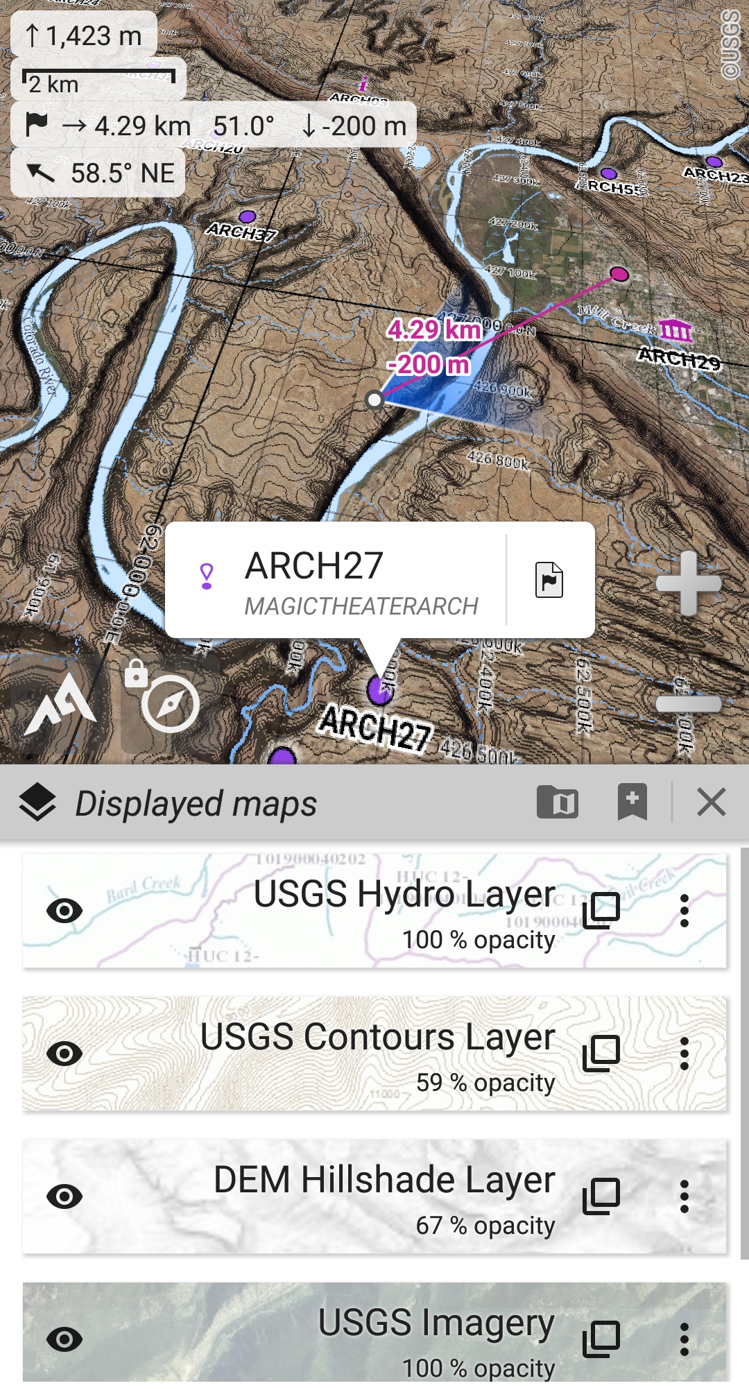
AlpineQuest is the complete solution for all outdoor activities and sports, including hiking, running, trailing, hunting, sailing, geocaching, off-road navigation and much more.
You can access and store locally a large range of on-line topographic maps, which will remain available even while being out of cell coverage. AlpineQuest also supports many on-board file-based raster map formats.
By using the GPS and the magnetic sensor of your device (with compass display), getting lost is part of the past: you are localized in real-time on the map, which can also be oriented to match where you are looking at.
Save and retrieve unlimited placemarks, share them with your friends. Track your path, get advanced statistics and interactive graphics. You won’t have anymore questions about what you can accomplish.
By staying fully operational out of cell coverage (as often in mountain or abroad), AlpineQuest assists you in all your desires of deep wilderness exploring…
Don’t hesitate, use this Lite version right now for free!
PLEASE report suggestions and issues on our dedicated forum https://www.alpinequest.net/forum (no registration needed, all questions answered) and not in comments.
Key features are (for full version):
★★ Maps ★★
• Built-in online maps (with automatic local storage; road, topo and satellite maps included) and online layers (road names, hillshade, contours);
• Get more online maps and layers in one click from the included community maps list (all major worldwide maps and many local topo maps);
• Complete area storage of online maps for off-line use;
• On-board offline maps support (raster) including KMZ Overlays, OziExplorer OZFx2, OZFx3 (partly) and calibrated images, GeoTiff, GeoPackage GeoPkg, MbTile, SqliteDB and TMS zipped tiles (visit our website to get MOBAC, the free map creator);
• QuickChart Memory Map support (.qct maps only, .qc3 maps not compatible);
• Built-in image calibration tool to use any scan or picture as a map;
• Digital elevation model on-board storage (1-arcsec SRTM DEM) and support for HGT elevation files (both 1-arcsec and 3-arcsec resolutions) allowing display of terrain, hillshade and steep slopes;
• Polar maps (Arctic and Antarctic) support;
• Multiple maps in layers display, with per-map opacity/contrast/color/tint/blending control.
★★ Placemarks ★★
• Create, display, save, restore unlimited number of items (waypoints, routes, areas and tracks);
• Import/export GPX files, Google Earth KML/KMZ files and CSV/TSV files;
• Import ShapeFile SHP/PRJ/DBF, OziExplorer WPT/PLT, GeoJSON, IGC tracks, Geocaching LOC waypoints and export AutoCAD DXF files;
• Save and share online locations with other users using Community Placemarks;
• Details, advanced statistics and interactive graphics on various items;
• Time Controller to replay time-tagged tracks.
★★ GNSS Position / Orientation ★★
• On-map geolocation using device GNSS receivers (GPS/Glonass/Galileo/…) or Network;
• Map orientation, compass and target finder;
• Built-in GNSS/Barometric track recorder (long tracking capable, running in a separate and light process) with battery level and network strength recording;
• Proximity alerts and leave path alerts;
• Barometer support (compatible devices).
★★ And more ★★
• Metric, imperial, nautical and hybrid distance units;
• Latitude/Longitude and grid coordinate formats (WGS, UTM, MGRS, USNG, OSGB, SK42, Lambert, QTH, …) with on-map grids display;
• Ability to import hundreds of coordinate formats from https://www.spatialreference.org;
• …
AlpineQuest Off-Road Explorer (Lite) 2.3.8d Update
2.3.8b/c/d
• Added a new setting to set the display style and side of the menu bar;
• Improved support of recent Android versions;
• Improved backup and restore tool;
• New default URL when sharing coordinates as text;
• Added ability to set the application “Media” folder as default for placemarks, icons, pictures and file-based maps;
• Added Croatian and Persian translations;
• Various improvements and bug fixes.
Read More
Previous Versions More
AlpineQuest Explorer Lite
2.3.8d
APK
August 14, 2024
8.03 MB
Requires Android: Android 2.1+
Screen DPI: nodpi
SHA1: c81ac03b9b280b3ebaf31b5e5830fae4610edc11
Size: 8.03 MB
What's New:
2.3.8b/c/d
• Added a new setting to set the display style and side of the menu bar;
• Improved support of recent Android versions;
• Improved backup and restore tool;
• New default URL when sharing coordinates as text;
• Added ability to set the application “Media” folder as default for placemarks, icons, pictures and file-based maps;
• Added Croatian and Persian translations;
• Various improvements and bug fixes.
• Added a new setting to set the display style and side of the menu bar;
• Improved support of recent Android versions;
• Improved backup and restore tool;
• New default URL when sharing coordinates as text;
• Added ability to set the application “Media” folder as default for placemarks, icons, pictures and file-based maps;
• Added Croatian and Persian translations;
• Various improvements and bug fixes.
AlpineQuest Explorer Lite
2.3.8c
APK
June 7, 2024
8.01 MB
Requires Android: Android 2.1+
Screen DPI: nodpi
SHA1: 9b3e6d08e3b2c278f7981a9c6921ac65487d3a36
Size: 8.01 MB
What's New:
2.3.8b/c
• Improved support of recent Android versions;
• Improved backup and restore tool;
• New default URL when sharing coordinates as text;
• Added ability to set the application “Media” folder as default for placemarks, icons, pictures and file-based maps;
• Added Croatian and Persian translations;
• Various improvements and bug fixes.
AlpineQuest Explorer Lite
2.3.8b
APK
May 25, 2024
8.01 MB
Requires Android: Android 2.1+
Screen DPI: nodpi
SHA1: e0c9d1ccb19e9f702425af559bff6445952386f1
Size: 8.01 MB
What's New:
2.3.8b
• Improved support of recent Android versions;
• Improved backup and restore tool;
• New default URL when sharing coordinates as text;
• Added ability to set the application “Media” folder as default for placemarks, icons, pictures and file-based maps;
• Added Croatian and Persian translations;
• Various improvements and bug fixes.
AlpineQuest Explorer Lite
2.3.8
APK
March 28, 2024
7.86 MB
Requires Android: Android 2.1+
Screen DPI: nodpi
SHA1: 43cab6ccf722677ad5cb47d7a1e8bd24ee9cfe1c
Size: 7.86 MB
What's New:
2.3.8
• Added ability to backup and restore all the application data into or from a single file;
• Added ability to display arrows, distances and ETE along the real-time location and compass heading lines (to be activated in the application settings);
• Added new slope unit (glide ratio);
• And more.
• Added ability to backup and restore all the application data into or from a single file;
• Added ability to display arrows, distances and ETE along the real-time location and compass heading lines (to be activated in the application settings);
• Added new slope unit (glide ratio);
• And more.
More Information
Package Name:
Category:
Update Date:
2024-08-14
Latest Version:
2.3.8d
Need Update:
Available on:
Requirements:
Android 2.1+
Report:
Alternatives to AlpineQuest Off-Road Explorer (Lite)
Wikiloc - Trails of the World
Discover millions of trails for hiking, biking, trekking, GPS navigation routes
9.2 7K+
Organic Maps: Hike Bike Drive
Navigate with Privacy - Community-Driven & Open-Source
9.1 693
Magic Earth Navigation & Maps
GPS Navigation, Offline Maps and Crowd-sourced Traffic. Entirely free.
8.6 2K+
MAPS.ME: Offline maps GPS Nav
Worldwide offline navigation with maps and driving directions
8.3 97K+
Live Earth Map GPS Navigation
Explore GPS maps for earth navigation and discover famous places
8.1 152
Developer Apps
All-In-One Offline Maps
OfflineMaps offers you to access a wide range of maps!
8.9 4K+
SMS Locations Receiver
Display locations received in text messages on a map in one click.
8.2
AlpineQuest Off-Road Explorer
Turn your Android device into a real off-road GPS using off-line topo maps!
9.2 790