- Home
- Apps
- Maps & Navigation
- Avia Maps Aeronautical Charts
Avia Maps Aeronautical Charts
171 TRUSTED APP
v3.14.0 by Remy Webservices UG


About Avia Maps
Avia Maps (Package Name: com.mytowntonight.aviamap) is developed by Remy Webservices UG and the latest version of Avia Maps Aeronautical Charts 3.14.0 was updated on September 9, 2024. Avia Maps Aeronautical Charts is in the category of Maps & Navigation. You can check all apps from the developer of Avia Maps Aeronautical Charts and find 200 alternative apps to Avia Maps Aeronautical Charts on Android. Currently this app is for free. This app can be downloaded on Android 8.0+ on APKPure.fo or Google Play. All APK/XAPK files on APKPure.fo are original and 100% safe with fast download.
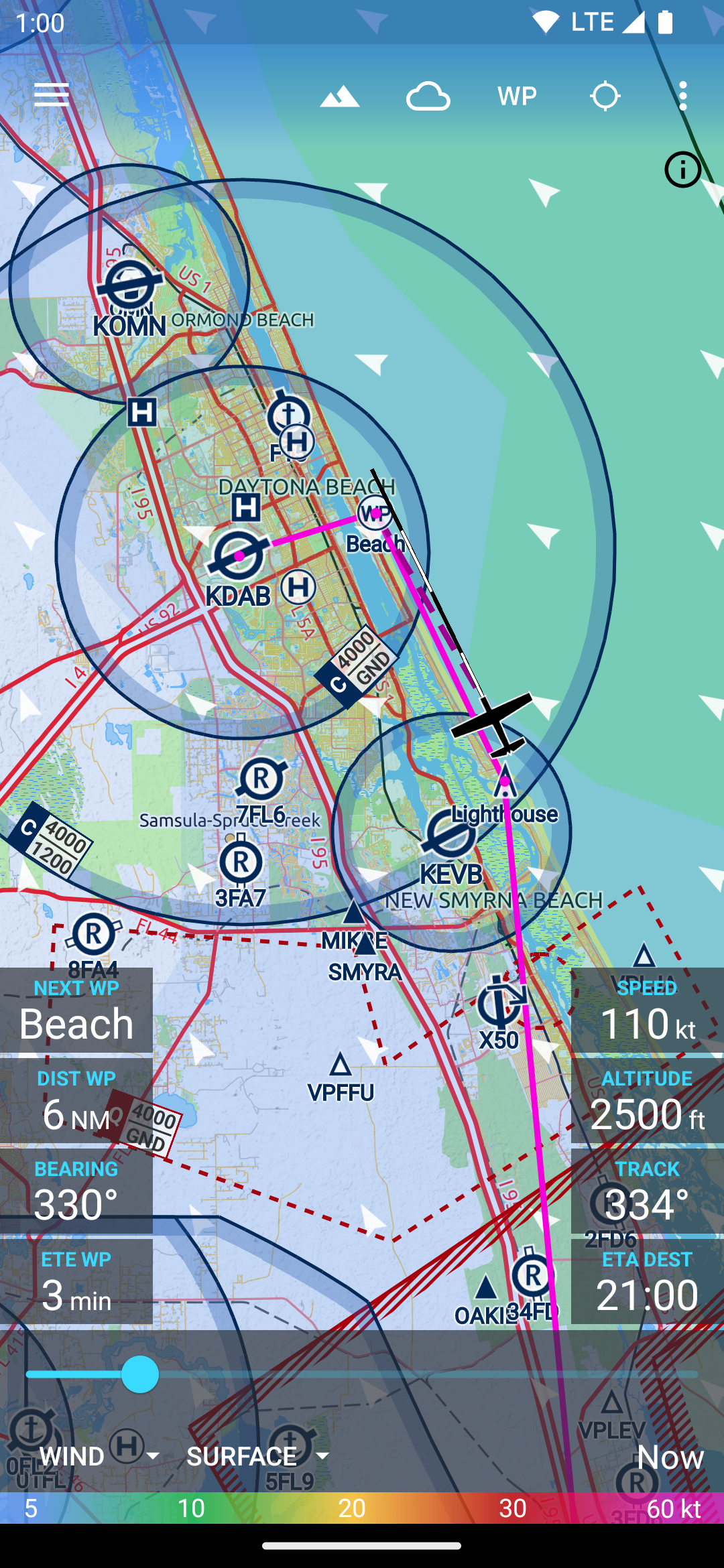
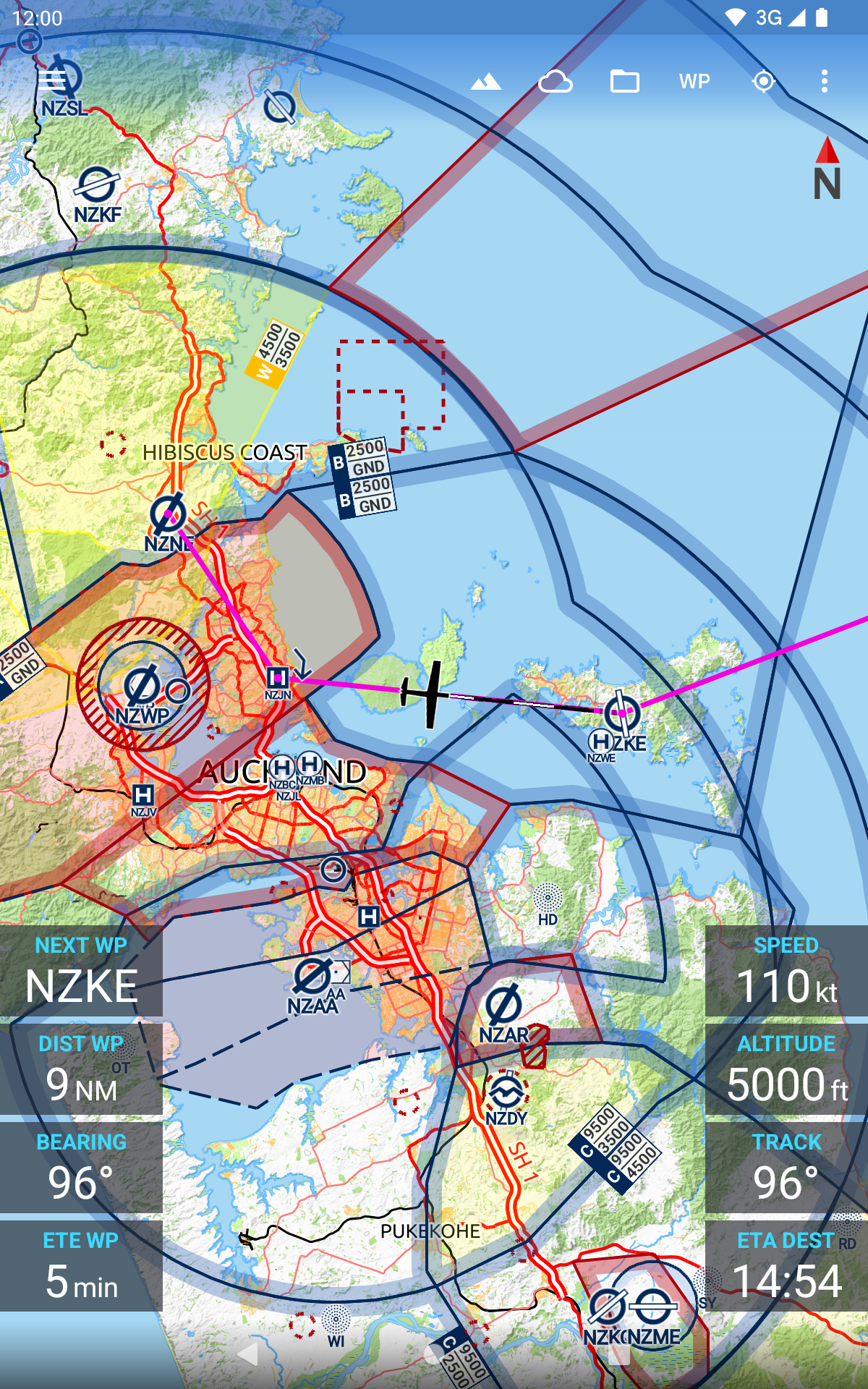
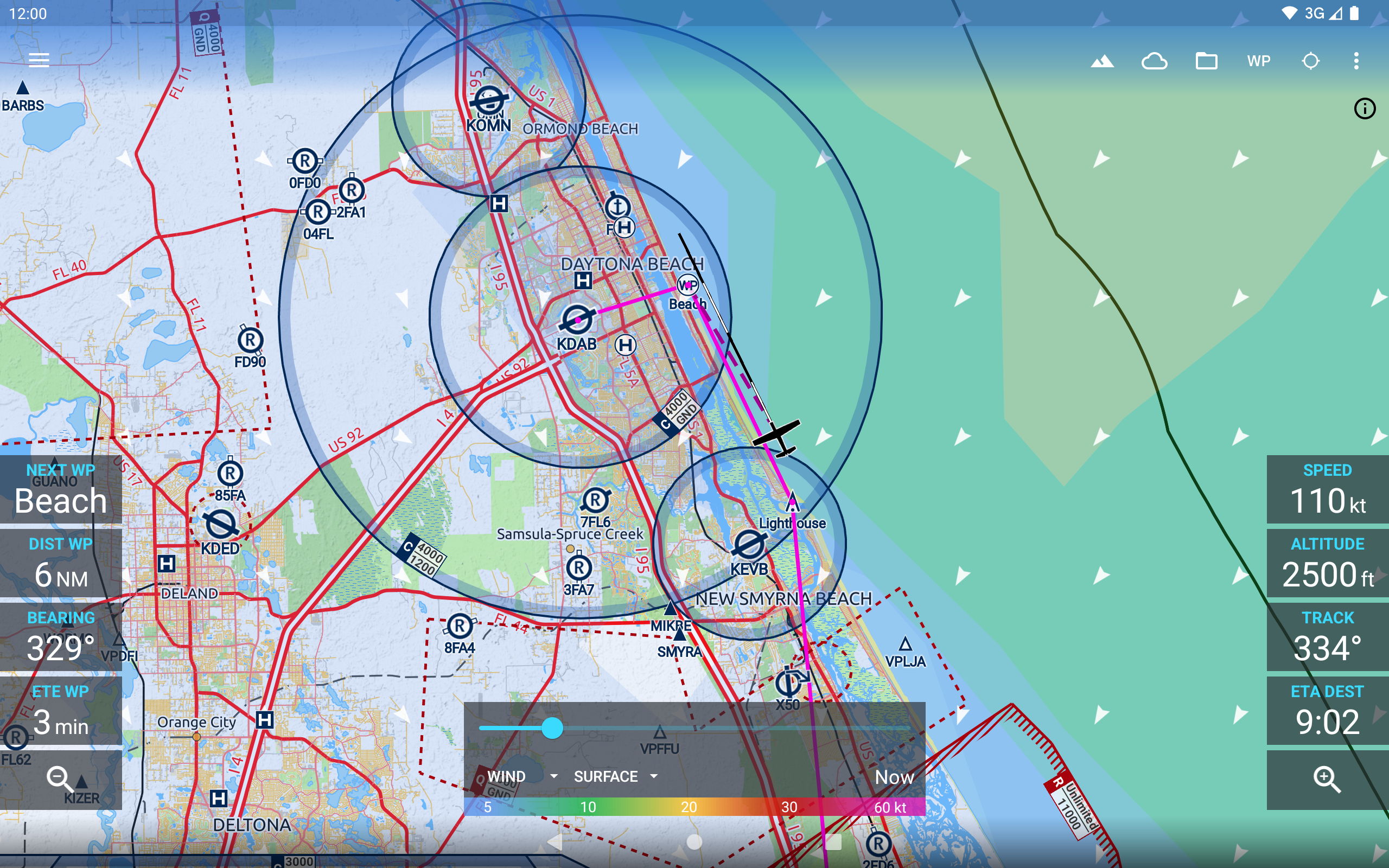
The reliable and straightforward aviation maps for pilots and aerospace enthusiasts around the world. The app is suited for pre-flight planning as well as in-flight navigation. Simply choose any 5 by 5 degree area on earth and download relevant data for offline use. The map features over 65000 airports, 9000 navaids and 15000 waypoints around the globe, just as airspaces for currently 62 countries on all continents (except Antarctica). Countries with airspace data include the United States and Canada, Europe, Australia and New Zealand.
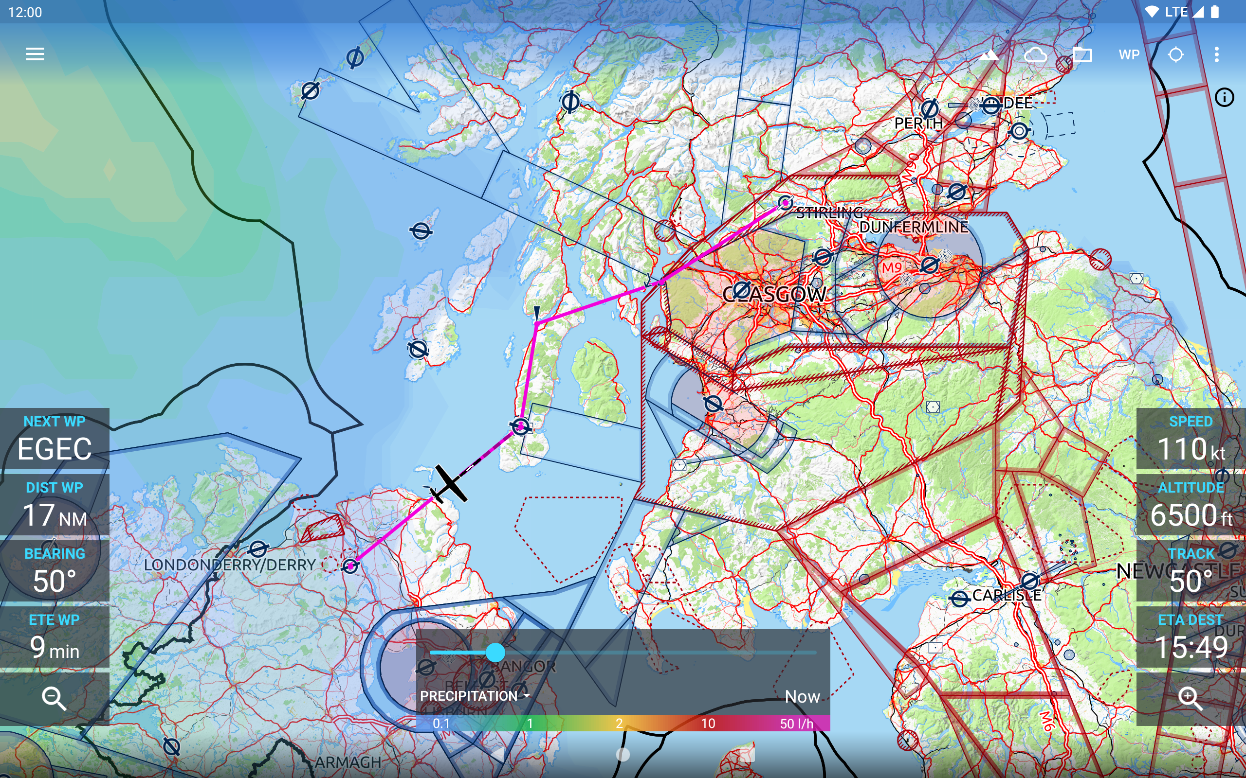
Global, high resolution weather forecasts from the German DWD and US American NOAA provide accurate map layers for cloud cover, ceiling, precipitation, wind on the ground as well as aloft. The data is downloaded onto the device, so you can check the forecast even during flight without cell reception. To retrieve the latest METAR and TAF at your destination airport it is integrated with Avia Weather.
A digital elevation model supports you with planning your route in the mountains. During flight the terrain overlay will dynamically color hills and mountains on the map depending on your current altitude to increase your situational awareness.
To enhance safety, Avia Maps can display traffic information from your favorite ADS-B receiver or from the SafeSky app directly on the map. It supports receiving traffic data using the GDL90 format, which is supported by most portable ADS-B receivers like SkyEcho or Stratux. If you do not have a receiver, SafeSky can provide traffic data using an internet connection only.
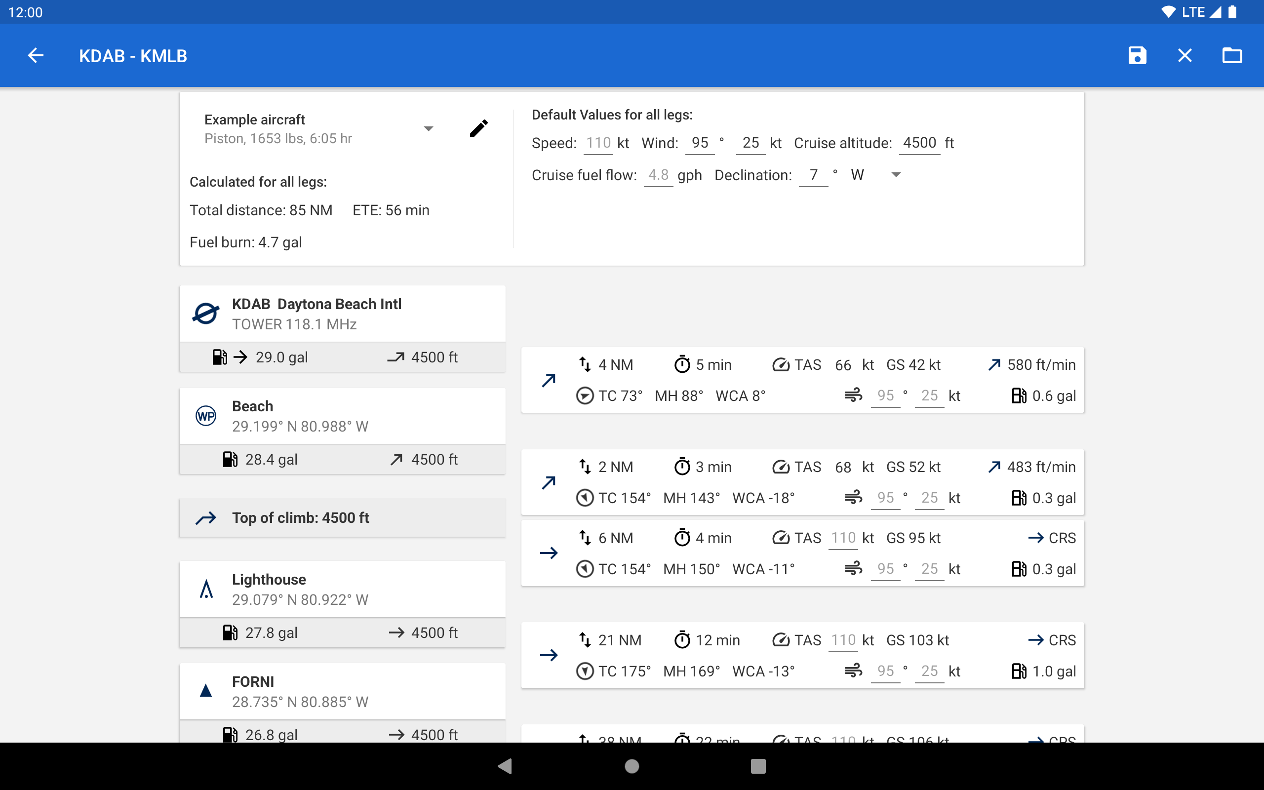
For the most accurate performance calculations you can create multiple aircraft profiles from handbook values for climb performance, fuel consumption etc. Route calculations will use these profiles and even consider engine type and fuel burn for climb performance, employing common formulae used in aerospace engineering. From as little as four carefully chosen data points the app can accurately recreate the climb performance diagram in your POH.
For clarity and commonality to paper charts the map is themed in the style of ICAO Annex 4 (Aeronautical Charts). If you use the app on multiple devices you can synchronize your routes, aircraft profiles and user waypoints between them.
This is a trial app with full features. After an evaluation period of 30 days you will have to buy a perpetual license from within the app or subscribe to the professional tier.
Global, high resolution weather forecasts from the German DWD and US American NOAA provide accurate map layers for cloud cover, ceiling, precipitation, wind on the ground as well as aloft. The data is downloaded onto the device, so you can check the forecast even during flight without cell reception. To retrieve the latest METAR and TAF at your destination airport it is integrated with Avia Weather.
A digital elevation model supports you with planning your route in the mountains. During flight the terrain overlay will dynamically color hills and mountains on the map depending on your current altitude to increase your situational awareness.
To enhance safety, Avia Maps can display traffic information from your favorite ADS-B receiver or from the SafeSky app directly on the map. It supports receiving traffic data using the GDL90 format, which is supported by most portable ADS-B receivers like SkyEcho or Stratux. If you do not have a receiver, SafeSky can provide traffic data using an internet connection only.
For the most accurate performance calculations you can create multiple aircraft profiles from handbook values for climb performance, fuel consumption etc. Route calculations will use these profiles and even consider engine type and fuel burn for climb performance, employing common formulae used in aerospace engineering. From as little as four carefully chosen data points the app can accurately recreate the climb performance diagram in your POH.
For clarity and commonality to paper charts the map is themed in the style of ICAO Annex 4 (Aeronautical Charts). If you use the app on multiple devices you can synchronize your routes, aircraft profiles and user waypoints between them.
This is a trial app with full features. After an evaluation period of 30 days you will have to buy a perpetual license from within the app or subscribe to the professional tier.
Avia Maps 3.14.0 Update
Change: Setting the initial climb altitude at the first airport and setting the cruise altitude of the route are now synonymous.
Change: The route is now displayed on the map using great circle segments.
Bugfix: On the advanced route planning screen, the unit of the cruise altitude was always "ft" (even if "m" were selected as unit).
Change: The route is now displayed on the map using great circle segments.
Bugfix: On the advanced route planning screen, the unit of the cruise altitude was always "ft" (even if "m" were selected as unit).
Read More
Previous Versions More
Avia Maps Aeronautical Charts
3.14.0
XAPK
APKs
September 7, 2024
38.81 MB
Variant
Arch
Version
DPI
Avia Maps Aeronautical Charts
3.13.1
XAPK
APKs
July 15, 2024
38.79 MB
Variant
Arch
Version
DPI
Avia Maps Aeronautical Charts
3.12.5b
APK
July 15, 2024
38.91 MB
Requires Android: Android 6.0+
Architecture: arm64-v8a, armeabi-v7a, x86, x86_64
Screen DPI: 120-640dpi
SHA1: bba69e1fa52a2a2f986cee2cc11dad7470339580
Size: 38.91 MB
What's New:
NEW: Added plus/minus buttons to terrain and weather overlay control views
Change: Several performance improvements to increase responsiveness and drawing speed of map overlays.
Bugfix: Possible deadlock when opening waypoint dialog
Change: Several performance improvements to increase responsiveness and drawing speed of map overlays.
Bugfix: Possible deadlock when opening waypoint dialog
Avia Maps Aeronautical Charts
3.12.5b
XAPK
APKs
July 24, 2024
38.54 MB
Variant
Arch
Version
DPI
More Information
Package Name:
Category:
Update Date:
2024-09-09
Latest Version:
3.14.0
Need Update:
Available on:
Requirements:
Android 8.0+
Report:
Alternatives to Avia Maps
Earthmate
Text and Navigate with inReach
4.1 100
Air Traffic - flight tracker
Flight tracker with plane photos. Flight radar of live planes on a map.
9.1 11K+
StreetComplete
OpenStreetMap surveyor app
9.7 103
UAV Forecast for Drone Pilots
Weather, GPS satellites, solar activity (Kp), No-Fly Zones and FAA TFRs
9.4 880
Windfinder: Wind & Weather map
Wind forecast, reports, tides & waves for sailing, kite, surf, boating & outdoor
9.4 6K+