- Home
- Apps
- Maps & Navigation
- CarryMap


About CarryMap
CarryMap (Package Name: com.dataeast.carrymap) is developed by XTools Pro and the latest version of CarryMap 6.1 was updated on October 24, 2024. CarryMap is in the category of Maps & Navigation with the feature Productivity. You can check all apps from the developer of CarryMap and find 173 alternative apps to CarryMap on Android. Currently this app is for free. This app can be downloaded on Android 6.0+ on APKPure.fo or Google Play. All APK/XAPK files on APKPure.fo are original and 100% safe with fast download.
Collect field data, add and edit point, line, and polygon features on your mobile map, share your data with peers.
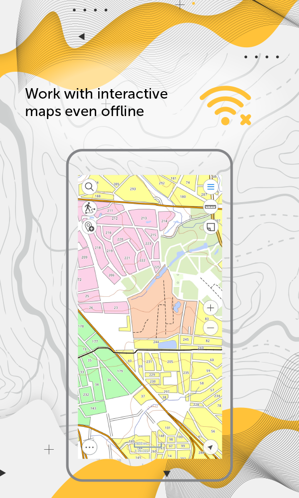
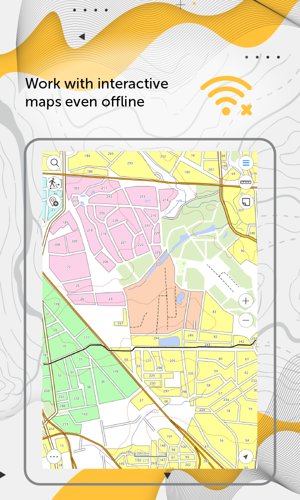
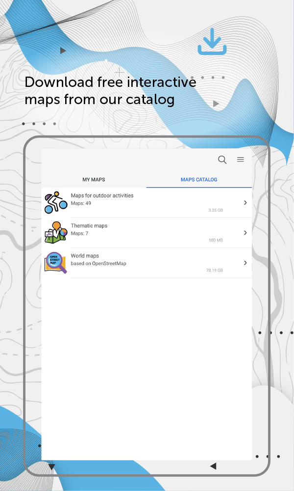
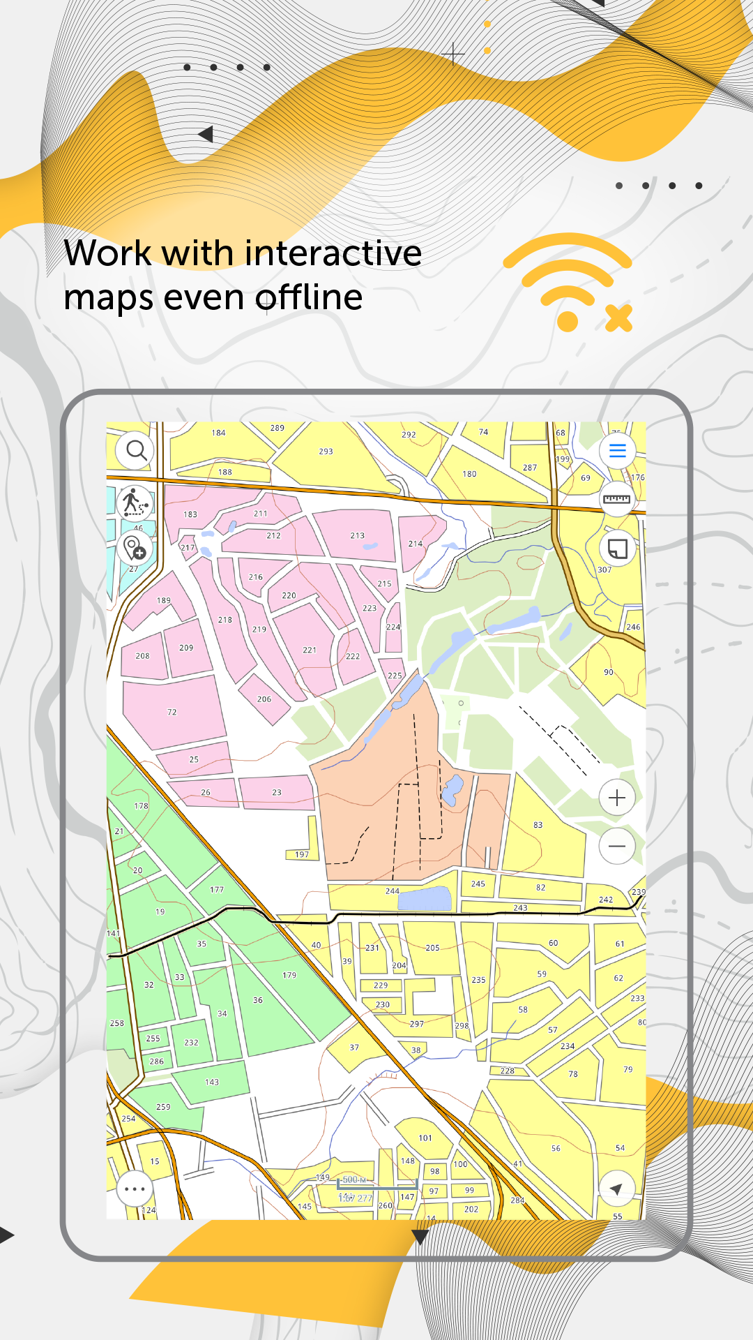
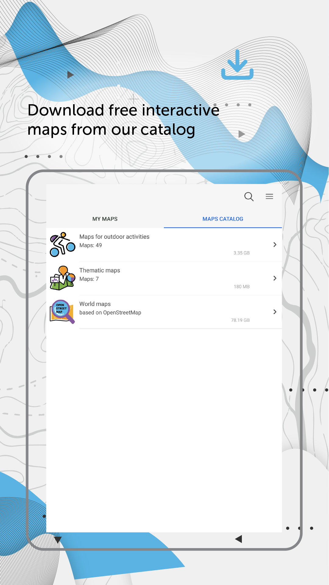
Access your maps everywhere you go, all app features are available even offline. CarryMap provides seamless field work without authorization, payments and in-app purchases. With the app you can use maps prepared in ArcGIS or download free maps covering various territories from our catalog. The maps provided in the catalog were created based on OpenStreetMap data.
1. Work in the app without authorization, payments and in-app purchases.
2. Add your own maps or download free maps from our catalog.
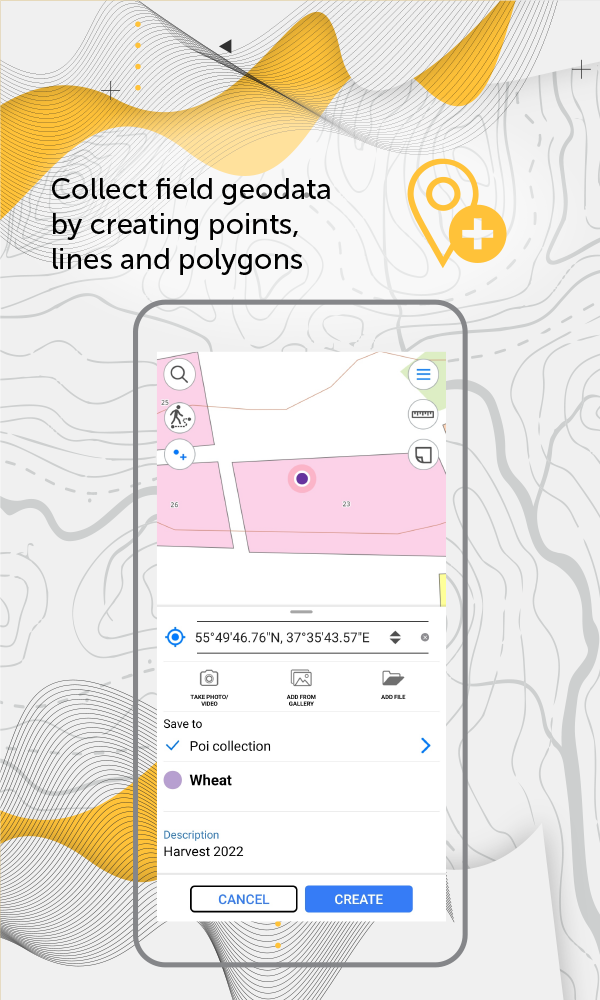
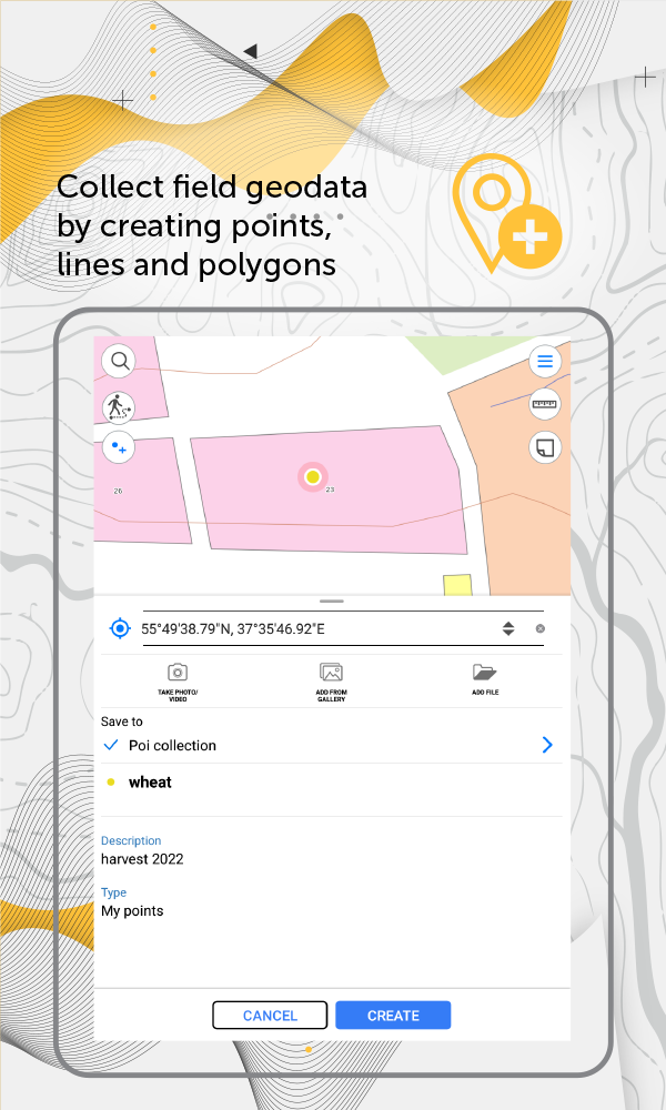
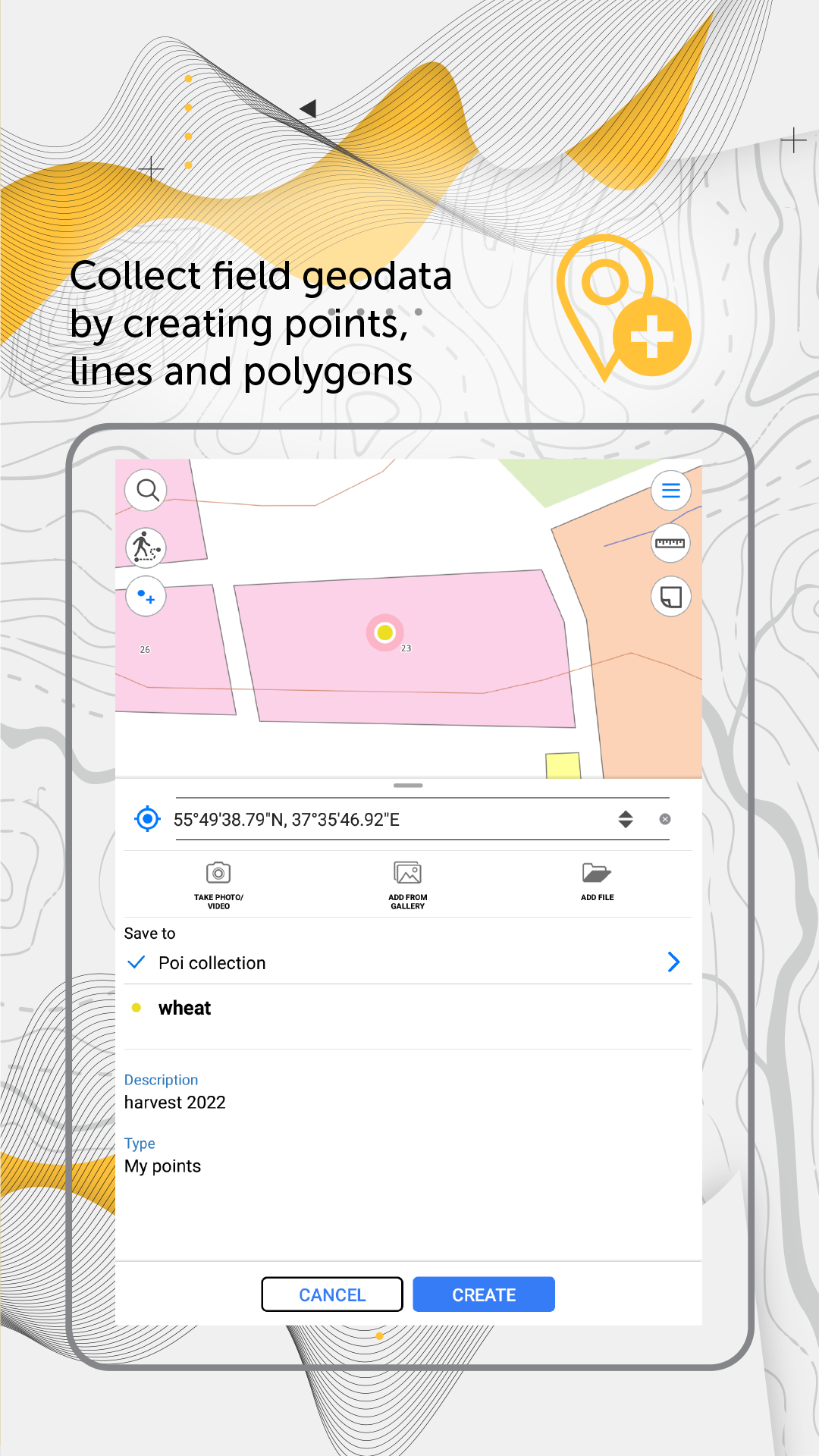
3. Create and edit point, line, and polygon features on map.
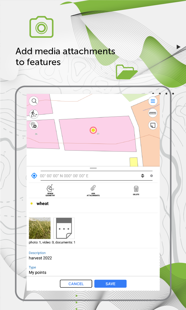
4. Add media attachments (photo, video and documents) to features.
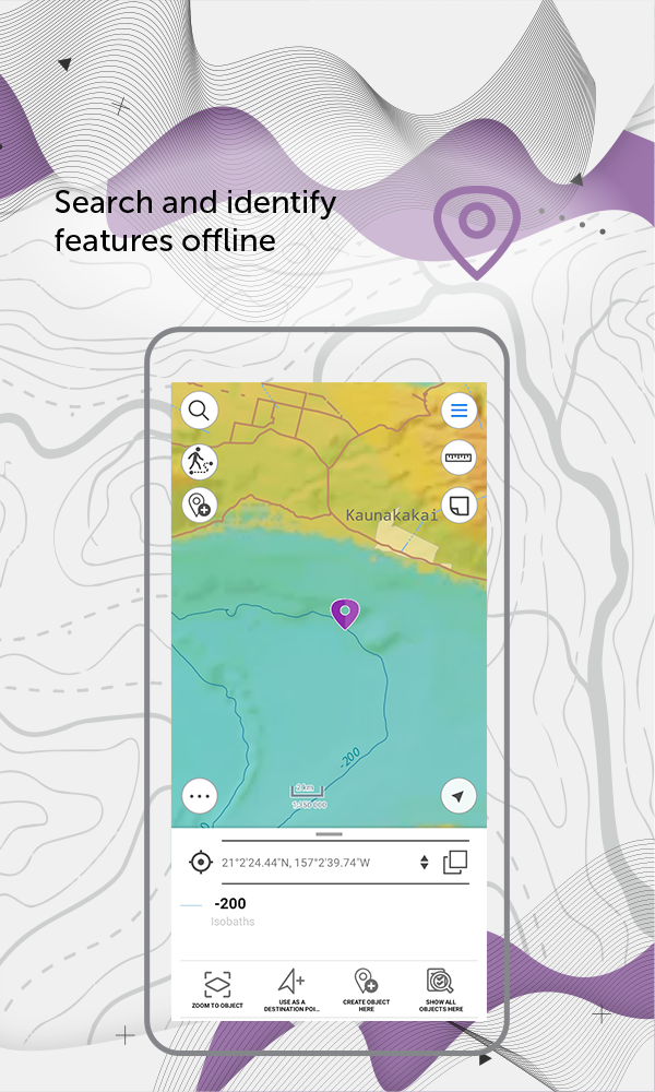
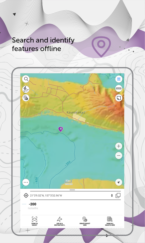
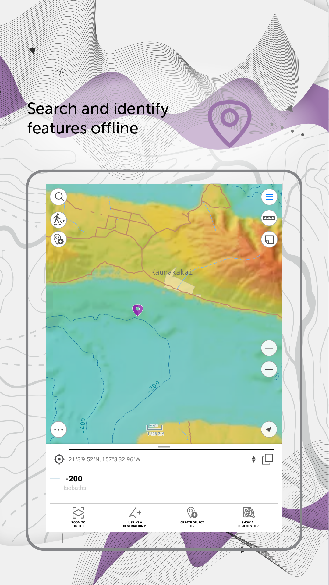
5. Search and identify features offline.
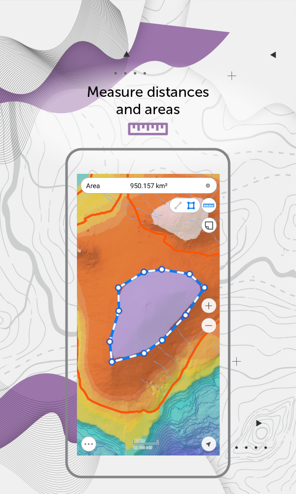
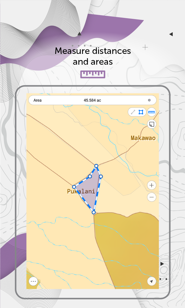
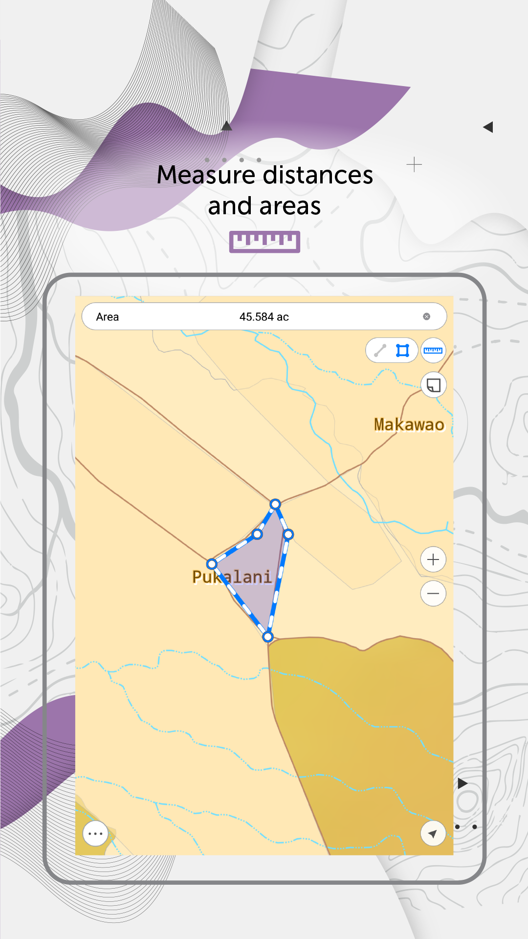
6. Measure distances and areas.
7. Create points on-the-fly using your device camera.
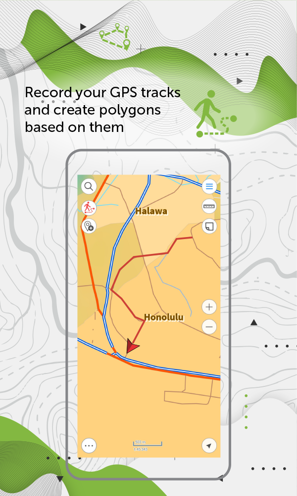
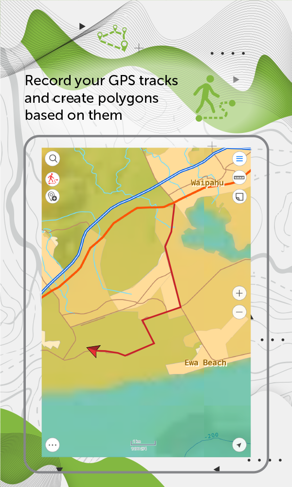
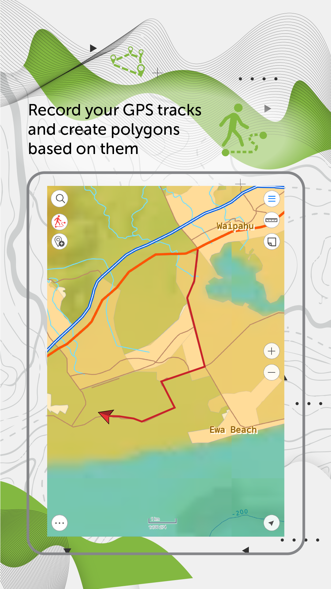
8. Record your GPS tracks and create polygons based on them
9. Add graphic marks in the form of text, arrows or free hand graphic to the mobile map.
10. Use external Bad Elf GPS receiver to find your current location.
11. Save selected map areas as bookmarks for quicker access.
12. Use map features as landmarks or destination points.
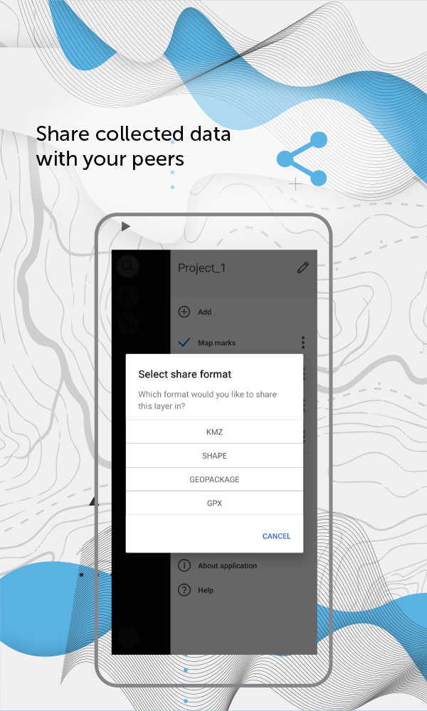
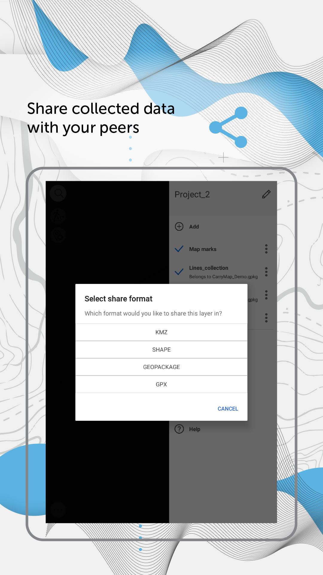
13. Share collected data in GPKG, GPX, KML/KMZ and SHP formats.
Specialists from electrical energy industry, agriculture, geology and geodesy, housing and utility, water and land resources management, ecology and incident management, urban management, and other areas worldwide successfully use CarryMap app for working with maps and solving their everyday job tasks.
CarryMap app is provided for work with maps of specific mobile format CMF2. To export your ArcGIS maps to this format, you will need CarryMap Builder – an extension to ArcGIS Desktop. Visit https://builder.carrymap.com/ to learn more about CarryMap Builder.
To learn more about CarryMap application, visit https://carrymap.com.
Your questions or comments are welcome at [email protected].
Subscribe to our Facebook page at https://www.facebook.com/carrymap/.
Subscribe to our YouTube channel at https://www.youtube.com/c/CarryMap/videos.
Access your maps everywhere you go, all app features are available even offline. CarryMap provides seamless field work without authorization, payments and in-app purchases. With the app you can use maps prepared in ArcGIS or download free maps covering various territories from our catalog. The maps provided in the catalog were created based on OpenStreetMap data.
1. Work in the app without authorization, payments and in-app purchases.
2. Add your own maps or download free maps from our catalog.
3. Create and edit point, line, and polygon features on map.
4. Add media attachments (photo, video and documents) to features.
5. Search and identify features offline.
6. Measure distances and areas.
7. Create points on-the-fly using your device camera.
8. Record your GPS tracks and create polygons based on them
9. Add graphic marks in the form of text, arrows or free hand graphic to the mobile map.
10. Use external Bad Elf GPS receiver to find your current location.
11. Save selected map areas as bookmarks for quicker access.
12. Use map features as landmarks or destination points.
13. Share collected data in GPKG, GPX, KML/KMZ and SHP formats.
Specialists from electrical energy industry, agriculture, geology and geodesy, housing and utility, water and land resources management, ecology and incident management, urban management, and other areas worldwide successfully use CarryMap app for working with maps and solving their everyday job tasks.
CarryMap app is provided for work with maps of specific mobile format CMF2. To export your ArcGIS maps to this format, you will need CarryMap Builder – an extension to ArcGIS Desktop. Visit https://builder.carrymap.com/ to learn more about CarryMap Builder.
To learn more about CarryMap application, visit https://carrymap.com.
Your questions or comments are welcome at [email protected].
Subscribe to our Facebook page at https://www.facebook.com/carrymap/.
Subscribe to our YouTube channel at https://www.youtube.com/c/CarryMap/videos.
CarryMap 6.1 Update
• Added display of information from device's GPS receiver about your current location and movement parameters in the map window.
• Improved display style of the circular ruler elements on the map.
• New icons to display the current location on the map.
• Fixes addressing overall stability and performance.
• Improved display style of the circular ruler elements on the map.
• New icons to display the current location on the map.
• Fixes addressing overall stability and performance.
Read More


Previous Versions More
CarryMap
6.1
XAPK
APKs
October 24, 2024
68.86 MB
Requires Android: Android 6.0+
Architecture: arm64-v8a
Screen DPI: nodpi
SHA1: 21731413370552bed953da36caf8d7e32ca0074f
Size: 68.86 MB
What's New:
• Added display of information from device's GPS receiver about your current location and movement parameters in the map window.
• Improved display style of the circular ruler elements on the map.
• New icons to display the current location on the map.
• Fixes addressing overall stability and performance.
• Improved display style of the circular ruler elements on the map.
• New icons to display the current location on the map.
• Fixes addressing overall stability and performance.
CarryMap
6.0
APK
April 23, 2024
174.86 MB
Requires Android: Android 6.0+
Architecture: arm64-v8a, armeabi, armeabi-v7a, mips, x86, x86_64
Screen DPI: nodpi
SHA1: 45ffc0f332955e1401275004e6c5756ddb1b7c69
Size: 174.86 MB
What's New:
• New option to work with raster maps in MBTiles format.
• New ability to record and save voice comments (audio attachments) when creating and describing features on the map.
• New option to set and view Z coordinates of point features.
• New option to view information about traveled distance when moving to the destination point.
• Automatic creation of a point based on the user's location.
CarryMap
5.7.1
XAPK
APKs
February 27, 2024
54.76 MB
Variant
Arch
Version
DPI
CarryMap
5.7
APK
December 25, 2023
176.41 MB
Requires Android: Android 6.0+
Architecture: arm64-v8a, armeabi, armeabi-v7a, mips, x86, x86_64
Screen DPI: nodpi
SHA1: 7d2a0b0c0e25b9c03d49d7f7d6f37d4eb532d9bb
Size: 176.41 MB
What's New:
• Access to the data catalog is now available on the app start page.
• New option to determine the relative location on the map using circular ruler.
• New tool for measuring the geographical azimuth between points on the map.
• New tool for measuring the radius of a circle with the center at the selected point.
• New option to calculate the area of selected objects in hectares.
• Improved logic for saving the set of layers as the project.
More Information
Package Name:
Category:
Update Date:
2024-10-24
Latest Version:
6.1
Need Update:
Available on:
Requirements:
Android 6.0+
Report:
Alternatives to CarryMap
Ascott Star Rewards: Book Stay
Travel and Stay Rewarded
7.2 29
Locus GIS offline land survey
GIS application - offline data collector, mapper, area calculator and SHP editor
7.9 130
UTM Measure
Tools for Simple GIS, Mapping and Surveying tasks.
8.7 27
Mgrs & Utm Map
This app is military GPS coordinate systems helper. (MGRS, UTM & DMS Maps)
9.5 1K+
Ship Info
Ultimate ships' database
8.7 4K+