- Home
- App
- Mappe e navigatori
- Magic Earth Navigazione
Magic Earth Navigazione
2K+ APP AFFIDABILE
v7.1.24.38.73EEFEA8.5DC939DB di General Magic
Recensione dell'Editore
Magic Earth is a free turn-by-turn navigation app with downloadable maps and speed cameras alerts. • OpenStreetMap. Will do to maps what Wikipedia did to encyclopedia.
Su Magic Earth
Find the best route to your destination even without an internet connection. Magic Earth uses OpenStreetMap data and a powerful search engine to offer you the optimal routes for driving, biking, hiking and public transportation.
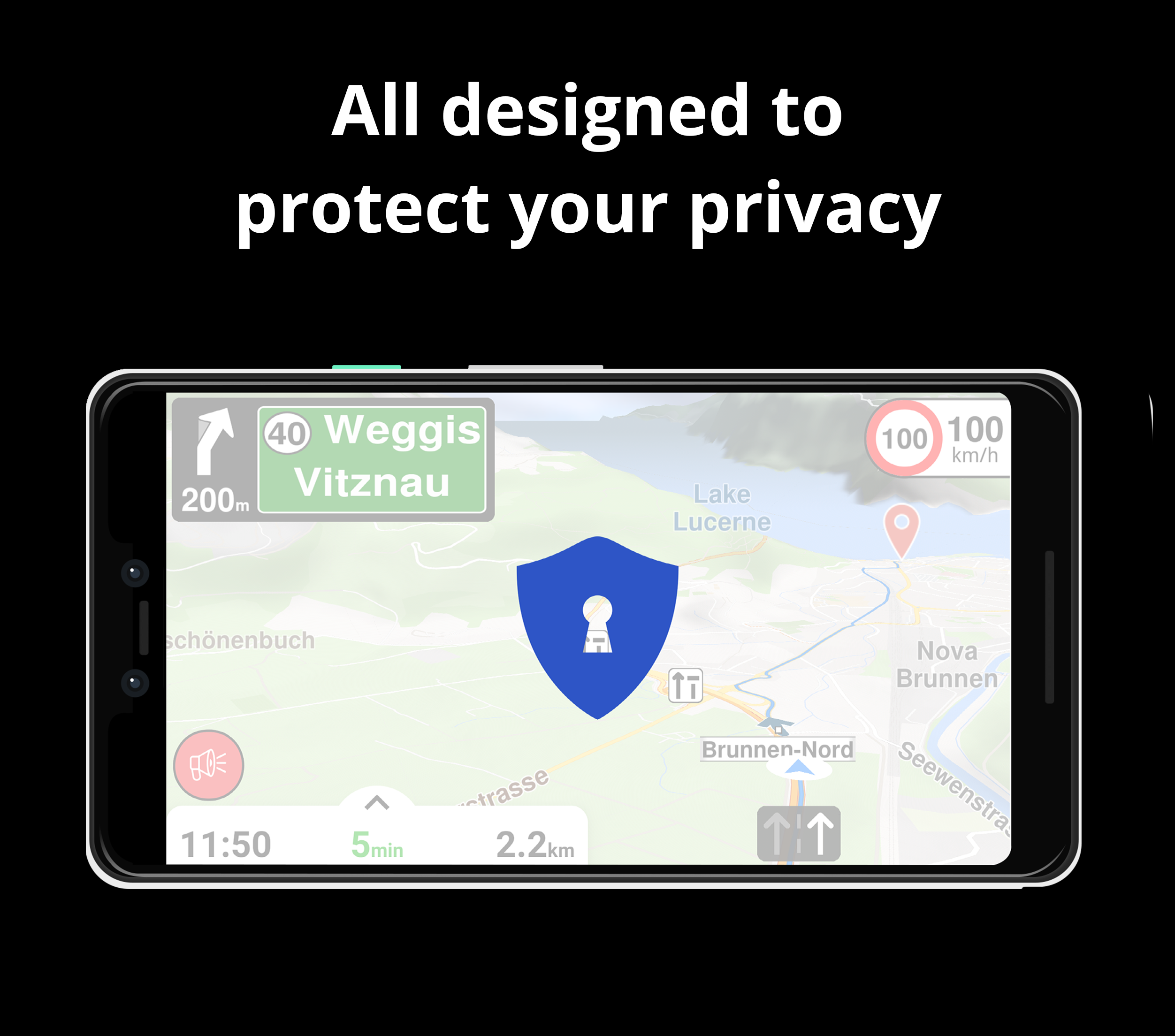
PRIVACY FIRST!
• We do not track you. We do not profile you. We do not trade in your personal data; moreover, we do not have it.
MAPS
• Save big on mobile internet costs and navigate reliably with offline maps powered by OpenStreetMap. 233 countries and regions are ready to be downloaded.
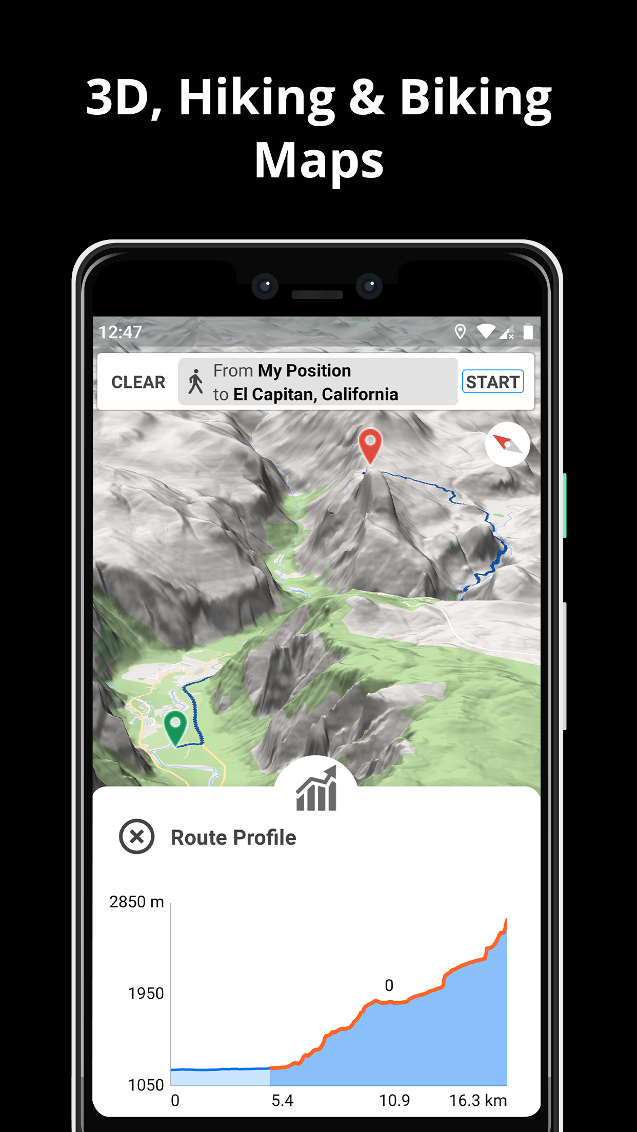
• Choose between 2D, 3D and Satellite map views.
• Get ready for travel and know every detail of your route like surface, difficulty, distance and elevation profile.
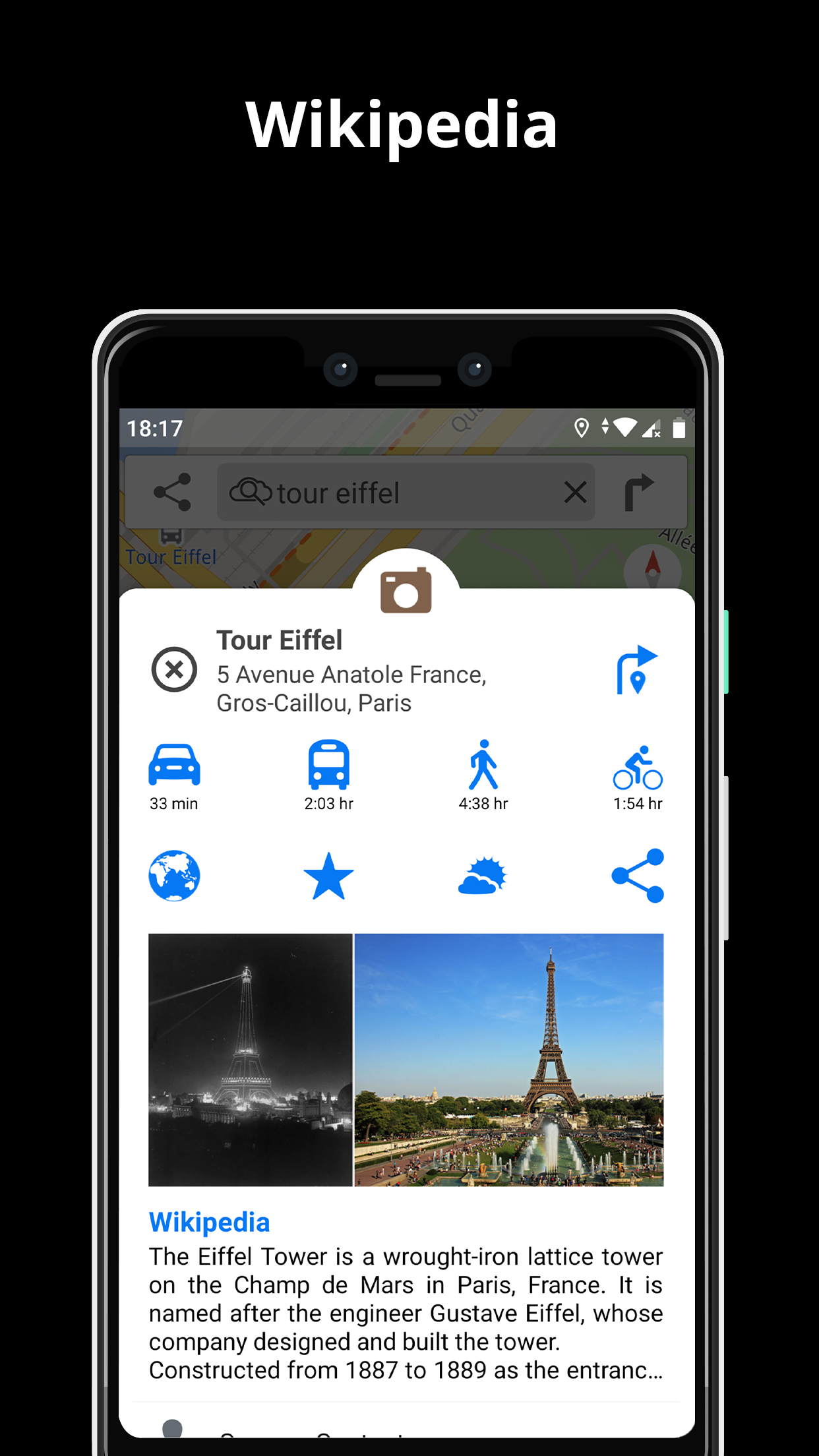
• Learn more about the points of interest near you from Wikipedia articles.
• Spot nearby parking places to easily park your car.
• Stay up-to-date and enjoy regular free map updates.
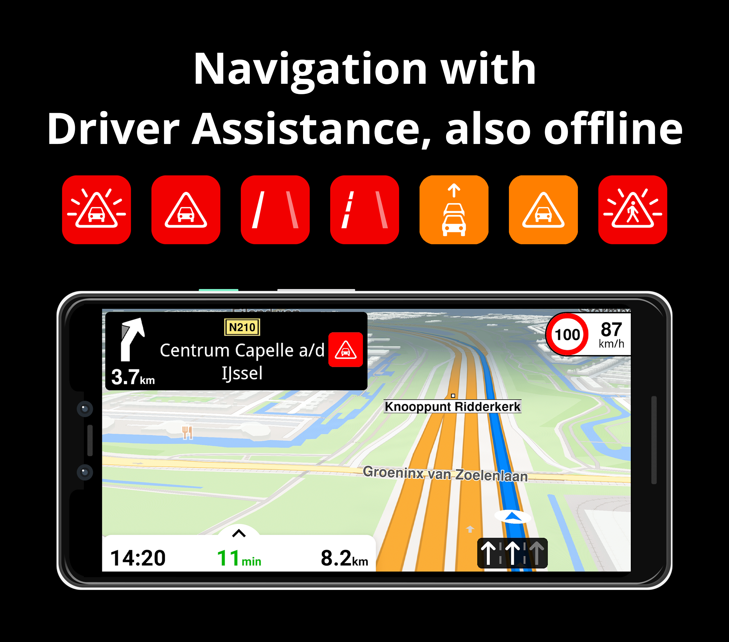
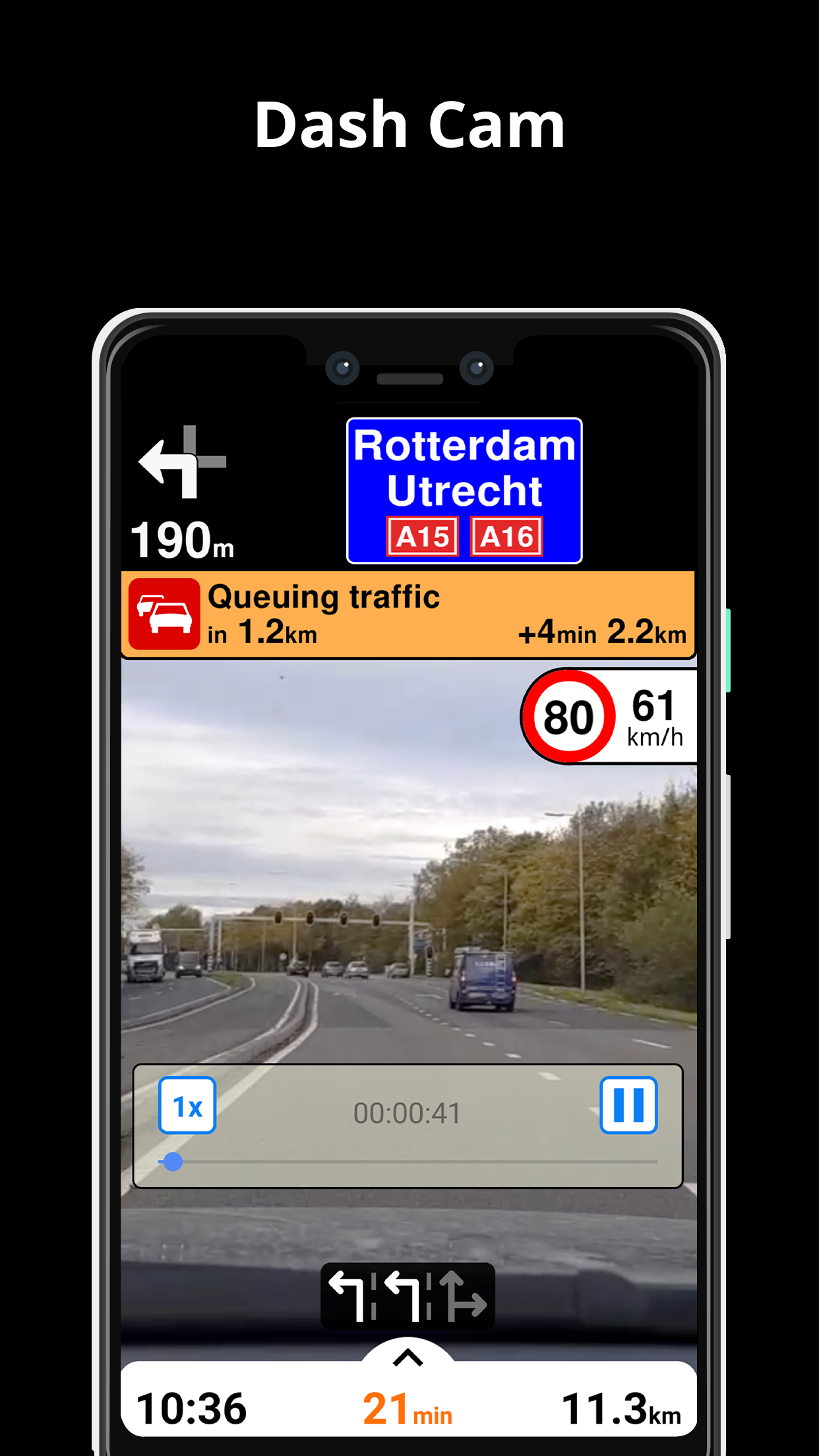
AI DASHCAM
• Improve safe driving and avoid accidents. Receive alerts to potential problems on the road and record your trip.
• AI DashCam features Driver Assistance warnings and Dash Cam functionality.
• Avoid collisions and accidents with Driver Assistance warnings: Headway Warning, Forward Collision Warning, Pedestrian Collision Warning, Lane Departure Warning, Leaving Lane Warning, Stop & Go Assist.
• Record the road ahead during navigation to have an aid in the event of a collision or incident.
• Driver Assistance warnings and Recordings are available when the device is on a car mount in landscape mode, with a clear view of the road ahead.
* AI DashCam (with Driver Assistance warnings and Dash Cam functionality) requires Android 7 or later.
NAVIGATION
• Find the fastest or the shortest route to your destination when you travel by car, bike, on foot or with public transport.
• Plan your route with multiple waypoints.
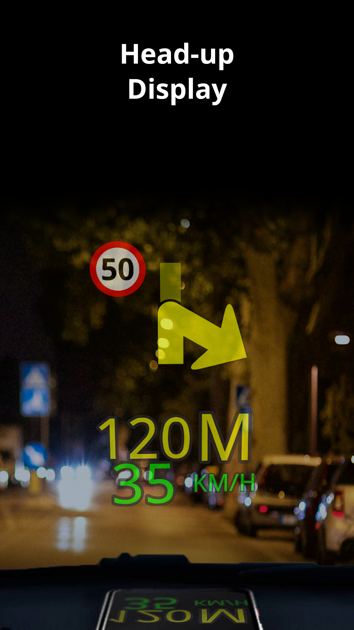
• Stay safe with the free Head-up Display (HUD) feature which projects the most important navigation info onto the windshield of your car.
• Know in advance which lane to take with precise turn-by-turn navigation and lane assistance.
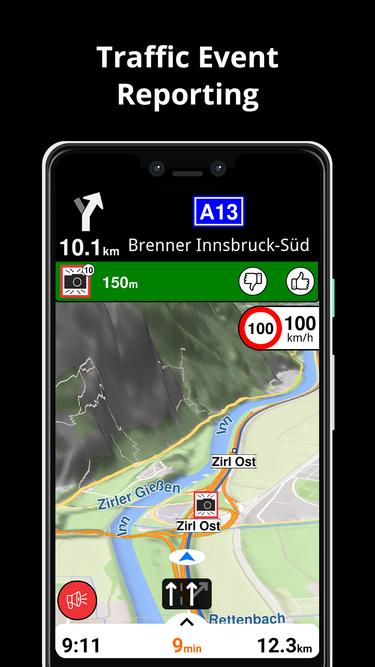
• Get notified about speed cameras and stay up to date with current speed limits.
TRAFFIC INFO
• Get real-time traffic info, updated every minute.
• Discover alternative routes that avoid the traffic jams and save you time on the road.
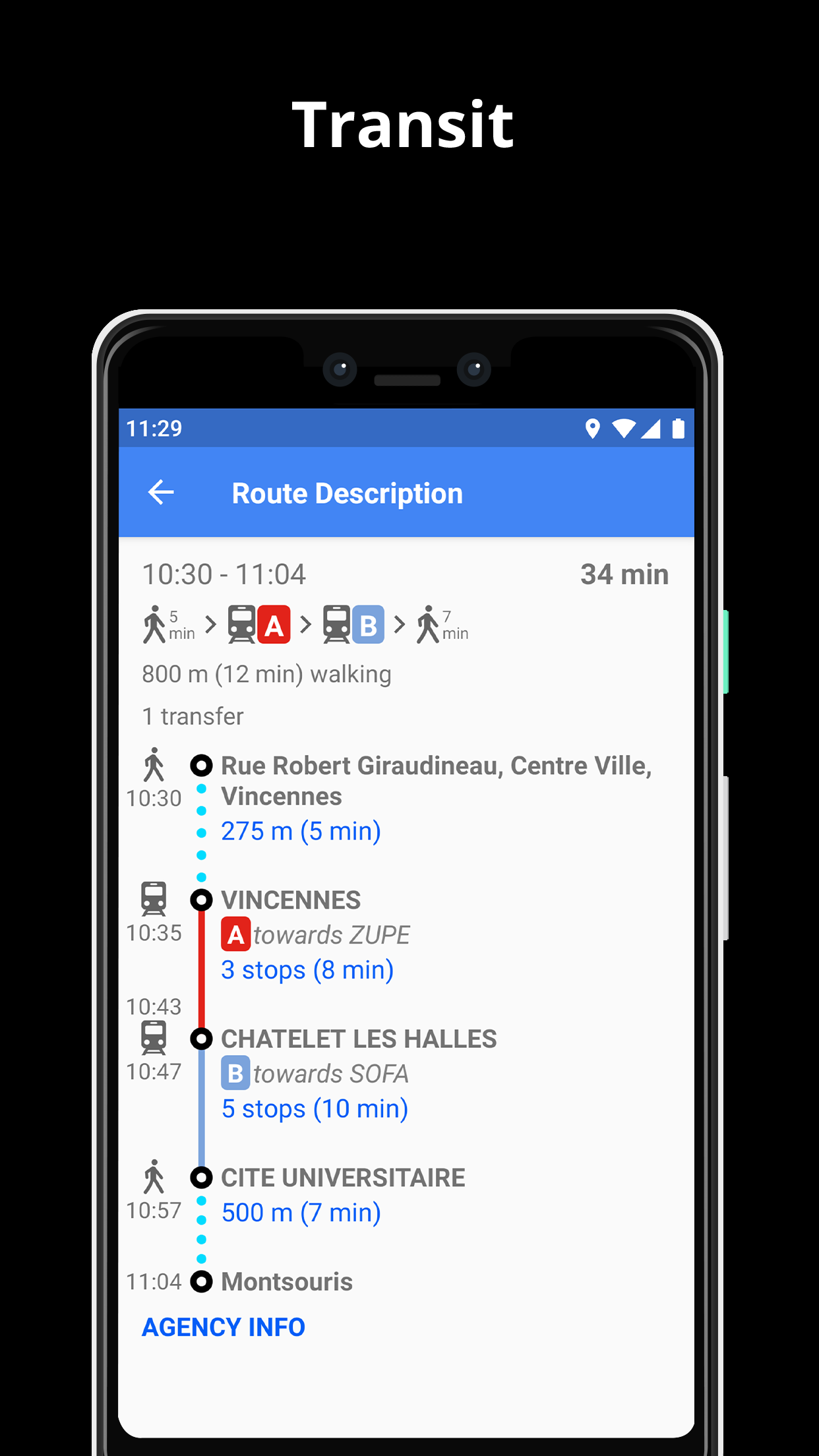
PUBLIC TRANSPORT
• Get around town quickly and easily. Choose from public transit routes that combine all transportation modes: bus / metro / subway / light rail / train / ferry
• Get walking directions, transfer times, departure times, number of stops. And when available, the cost.
• Find wheelchair or bike friendly public transportation.
WEATHER
• View current temperature and local weather forecast for your favorite locations.
• See what weather conditions to expect in the next hours and view the forecast for the next 10 days.
NOTES:
* Some features are not available in all countries.
* Some features require internet connection.
PRIVACY FIRST!
• We do not track you. We do not profile you. We do not trade in your personal data; moreover, we do not have it.
MAPS
• Save big on mobile internet costs and navigate reliably with offline maps powered by OpenStreetMap. 233 countries and regions are ready to be downloaded.
• Choose between 2D, 3D and Satellite map views.
• Get ready for travel and know every detail of your route like surface, difficulty, distance and elevation profile.
• Learn more about the points of interest near you from Wikipedia articles.
• Spot nearby parking places to easily park your car.
• Stay up-to-date and enjoy regular free map updates.
AI DASHCAM
• Improve safe driving and avoid accidents. Receive alerts to potential problems on the road and record your trip.
• AI DashCam features Driver Assistance warnings and Dash Cam functionality.
• Avoid collisions and accidents with Driver Assistance warnings: Headway Warning, Forward Collision Warning, Pedestrian Collision Warning, Lane Departure Warning, Leaving Lane Warning, Stop & Go Assist.
• Record the road ahead during navigation to have an aid in the event of a collision or incident.
• Driver Assistance warnings and Recordings are available when the device is on a car mount in landscape mode, with a clear view of the road ahead.
* AI DashCam (with Driver Assistance warnings and Dash Cam functionality) requires Android 7 or later.
NAVIGATION
• Find the fastest or the shortest route to your destination when you travel by car, bike, on foot or with public transport.
• Plan your route with multiple waypoints.
• Stay safe with the free Head-up Display (HUD) feature which projects the most important navigation info onto the windshield of your car.
• Know in advance which lane to take with precise turn-by-turn navigation and lane assistance.
• Get notified about speed cameras and stay up to date with current speed limits.
TRAFFIC INFO
• Get real-time traffic info, updated every minute.
• Discover alternative routes that avoid the traffic jams and save you time on the road.
PUBLIC TRANSPORT
• Get around town quickly and easily. Choose from public transit routes that combine all transportation modes: bus / metro / subway / light rail / train / ferry
• Get walking directions, transfer times, departure times, number of stops. And when available, the cost.
• Find wheelchair or bike friendly public transportation.
WEATHER
• View current temperature and local weather forecast for your favorite locations.
• See what weather conditions to expect in the next hours and view the forecast for the next 10 days.
NOTES:
* Some features are not available in all countries.
* Some features require internet connection.
Aggiornamento Magic Earth 7.1.24.38.73EEFEA8.5DC939DB
1. Aggiunto supporto per la registrazione di tracce GPX. Per abilitare la funzione, vai su "Impostazioni / Impostazioni avanzate" e attiva "Registra tracce GPX".
2. Aggiunto il supporto per la definizione dei blocchi stradali. Per aggiungere un blocco stradale su una determinata strada, toccala a lungo, quindi seleziona "Definisci blocco stradale" dalla visualizzazione dei dettagli della posizione e segui le istruzioni visualizzate.
3. Correzione di bug e miglioramenti della stabilità.
Leggi di Più
Versioni Precedenti Altro
Magic Earth Navigazione
7.1.24.38.73EEFEA8.5DC939DB
XAPK
APKs
September 20, 2024
137.31 MB
Variant
Arch
Version
DPI
Magic Earth Navigazione
7.1.24.33.EF5800AA.2619D2D5
XAPK
APKs
August 15, 2024
137.02 MB
Variant
Arch
Version
DPI
Magic Earth Navigazione
7.1.24.31.70F335B3.F57E41E3
XAPK
APKs
August 2, 2024
138.07 MB
Variant
Arch
Version
DPI
Magic Earth Navigazione
7.1.24.31.66011813.F6731D68
XAPK
APKs
July 29, 2024
137.91 MB
Variant
Arch
Version
DPI
Maggiori Informazioni
Nome Pacchetto:
Categoria:
Data Aggiornamento:
2024-09-20
Ultima Versione:
7.1.24.38.73EEFEA8.5DC939DB
Aggiornamento Necessario:
Disponibile su:
Requisiti:
Android 8.0+
Rapporto:
Potrebbe Anche Piacerti
Uber - Request a ride
No-stress ride options. Save the hassle and find a car in your city.
9.2 944K+
Яндекс Go: Такси Еда Доставка
Ordinazione taxi, consegna pacchi, scooter, mercato, car sharing, generi alimentari e cibo
9.7 1M+
inDrive. Save on city rides
More than a taxi app! Save on city rides: Set the price & get more as a driver!
9.6 735K+
Waze GPS e traffico live
Evita traffico, incidenti, autovelox, cantieri e prezzi del carburante elevati
8.7 672K+
Bolt: Richiedi una corsa
Pronto a partire?
9.6 481K+