- Home
- Apps
- Maps & Navigation
- GPS & Hiking maps
GPS & Hiking maps
67 TRUSTED APP
v4.22.07 by Cartes, Randonnées, GPS, GPX


About MaRando
MaRando (Package Name: com.morillon.marando) is developed by Cartes, Randonnées, GPS, GPX and the latest version of GPS & Hiking maps 4.22.07 was updated on September 8, 2024. GPS & Hiking maps is in the category of Maps & Navigation with the feature sports. You can check all apps from the developer of GPS & Hiking maps. Currently this app is for free. This app can be downloaded on Android 8.0+ on APKPure.fo or Google Play. All APK/XAPK files on APKPure.fo are original and 100% safe with fast download.
MA-Rando is the application created by hikers, for hikers.
Thanks to MA-Rando, you have more than a GPS in your pocket.
Whether you are a hiker, on skis, on horseback, on mountain bike, on bike, on snowshoe, or you practice trail running, running, hunting or picking mushrooms,
MA-Rando is the essential tool you need.
MOST
• Sound guidance allowing you to follow a route.
• Conservation of the history of your courses in an optimized manner (Example more than 500 courses stored). You can find your routes quickly thanks to numerous search criteria such as routes around a city of your choice.
• The history of your routes is visible on all your devices via your Google drive and thus guarantees the saving of your routes.
• For your safety, sending your GPS position by SMS is available.
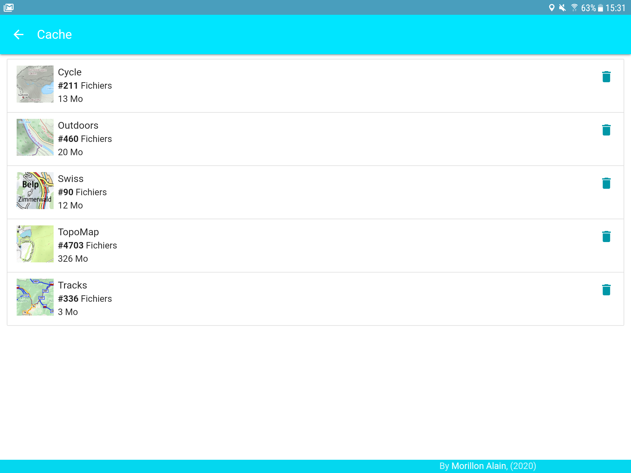
• Caching quality maps offline in the field
• The altitude difference and distance calculation algorithm has been worked on to be consistent with reality.
USES / FEATURES
• MA-Rando was designed to be intuitive and you will easily know how to use it.
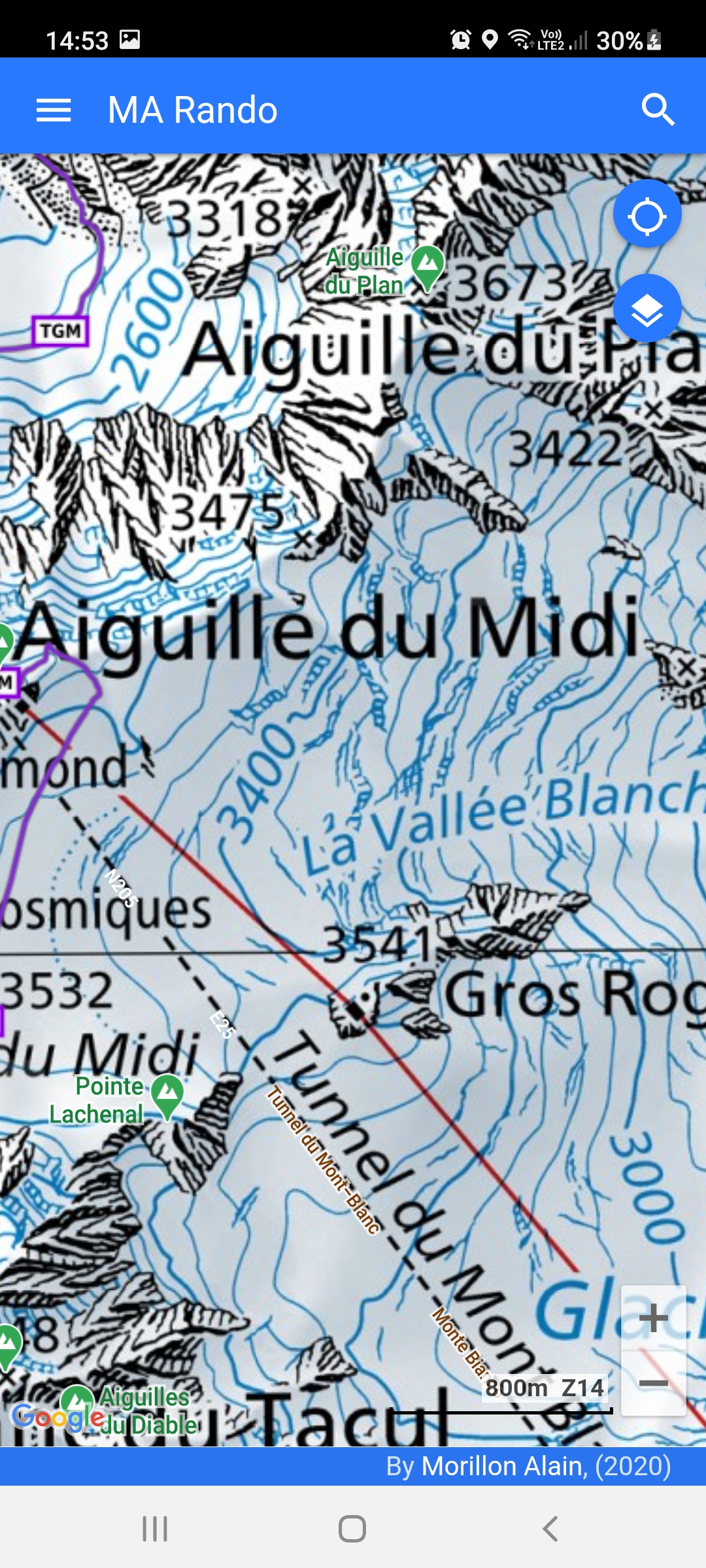
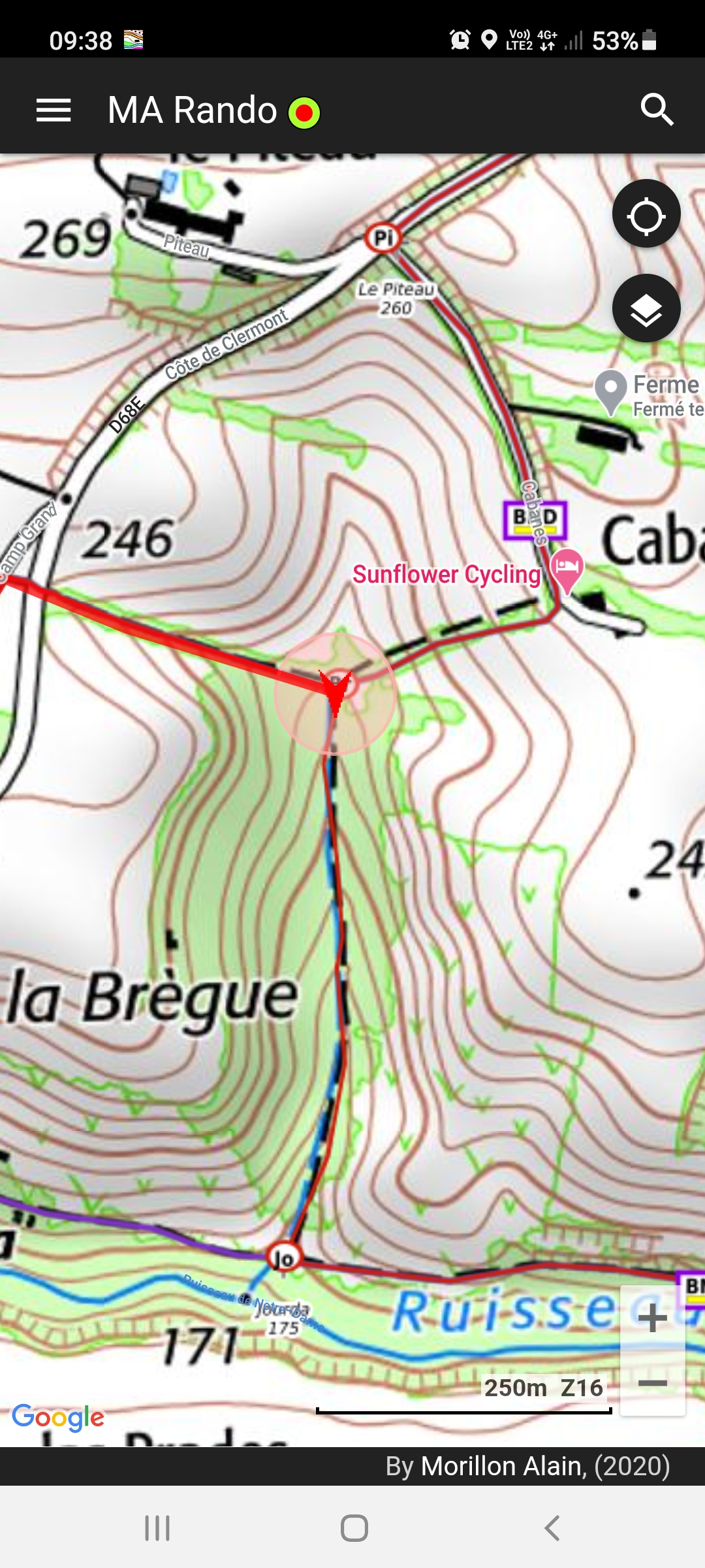
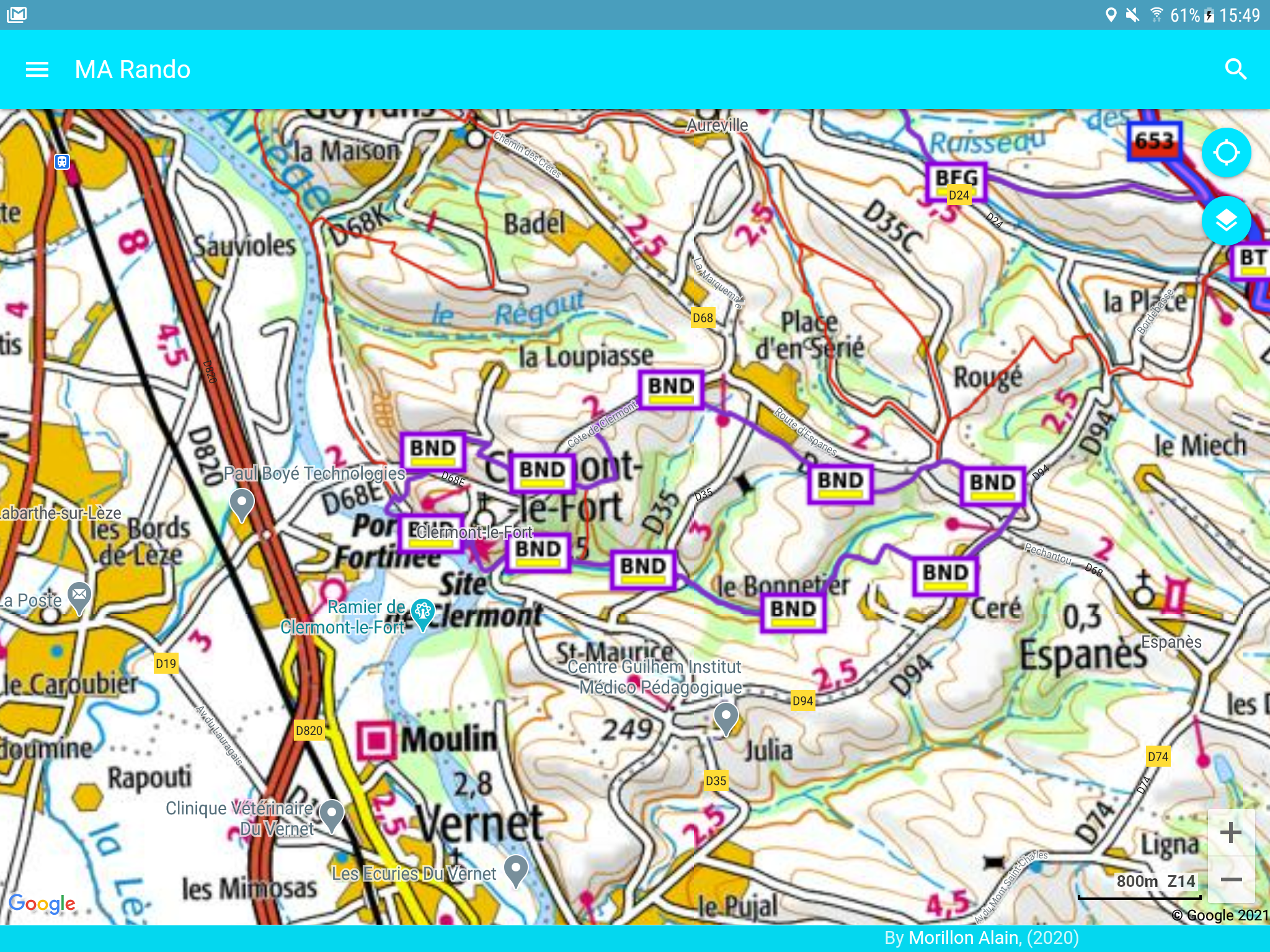
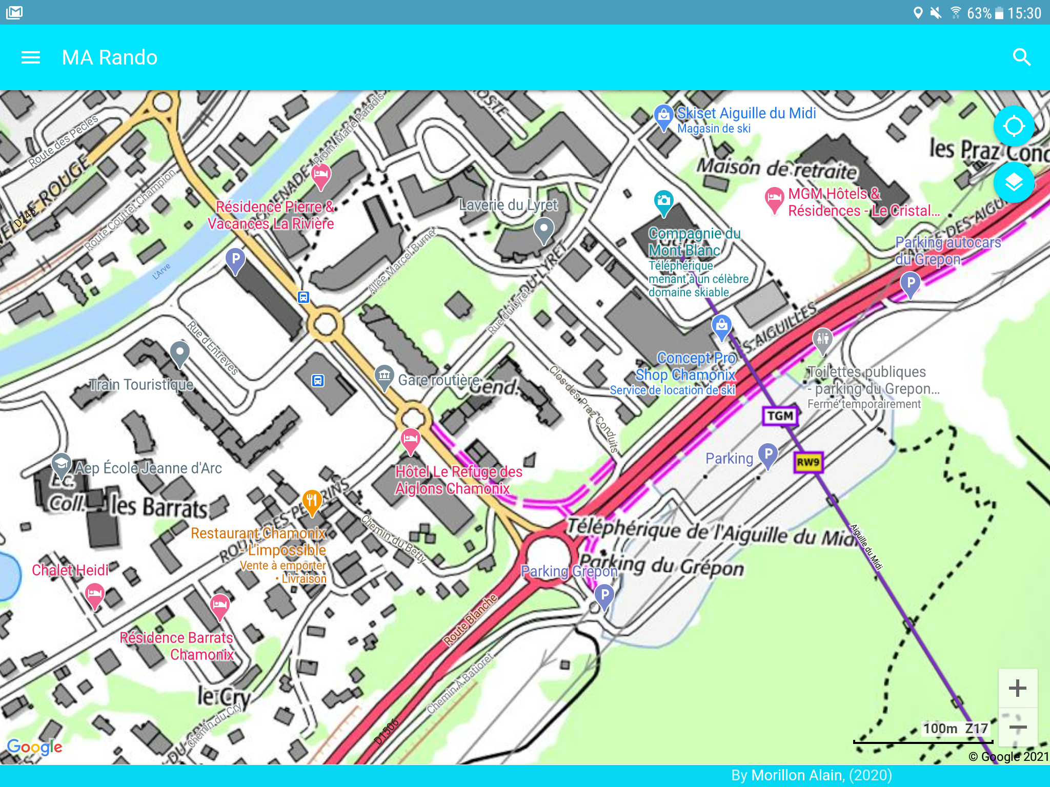
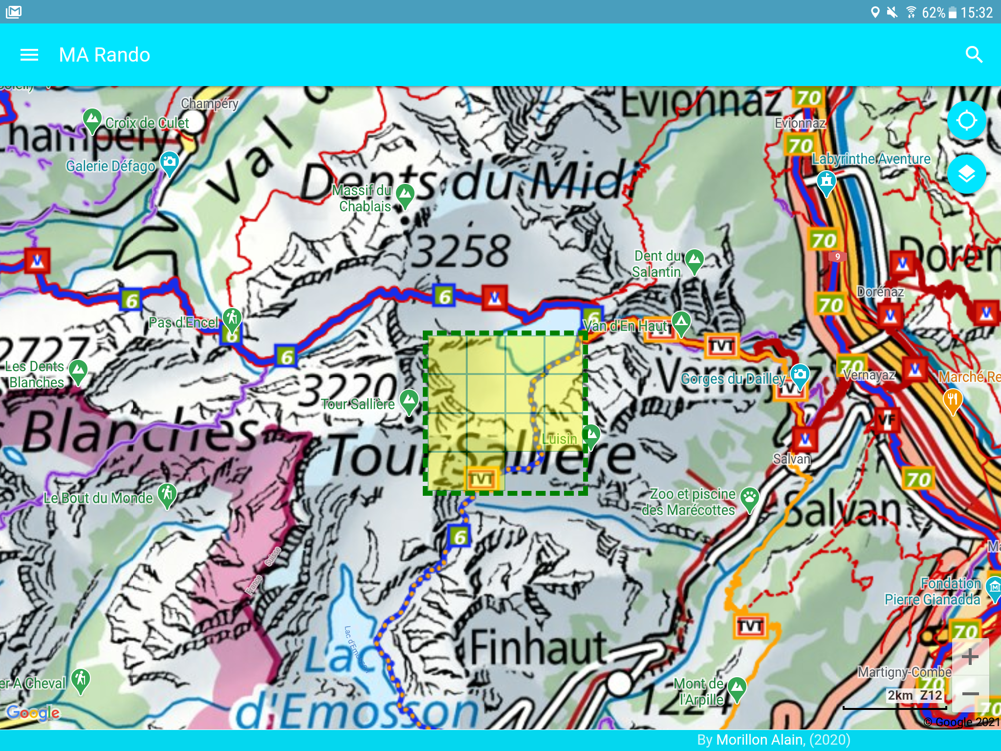
• To orient yourself in the field, MA-Rando indicates your position on quality base maps such as: CalTopo, Thunderforest, French, Spanish, Swiss, Belgian, 4uMap, OpenTopoMap...
• Of course, MA-Rando allows you to record your trip and remains very economical since recording can be done over more than one day.
• To prepare your trip, you can download the maps of your choice in advance. This action will keep you secure because when you are away from any network, the base cards will remain displayed.
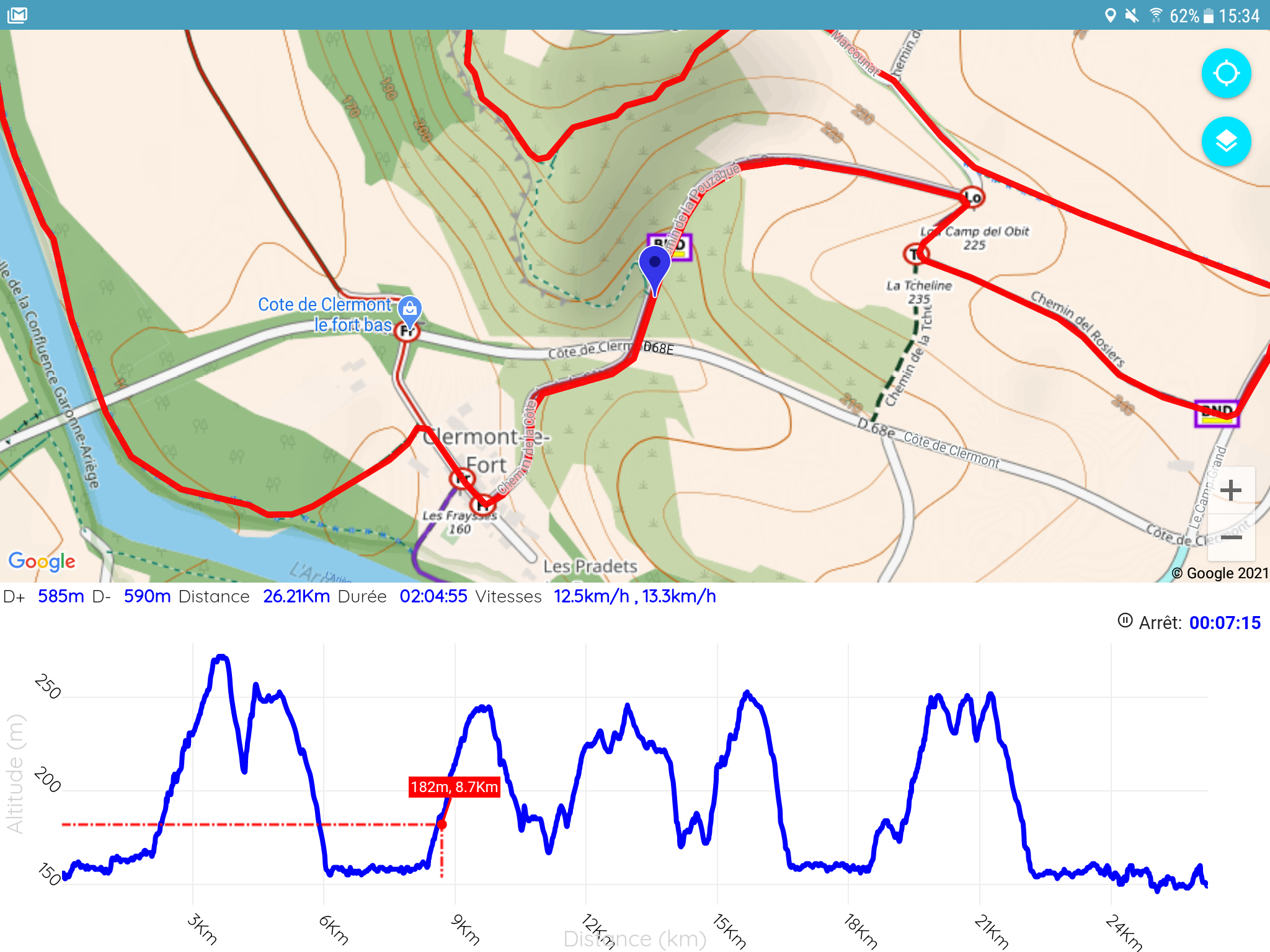
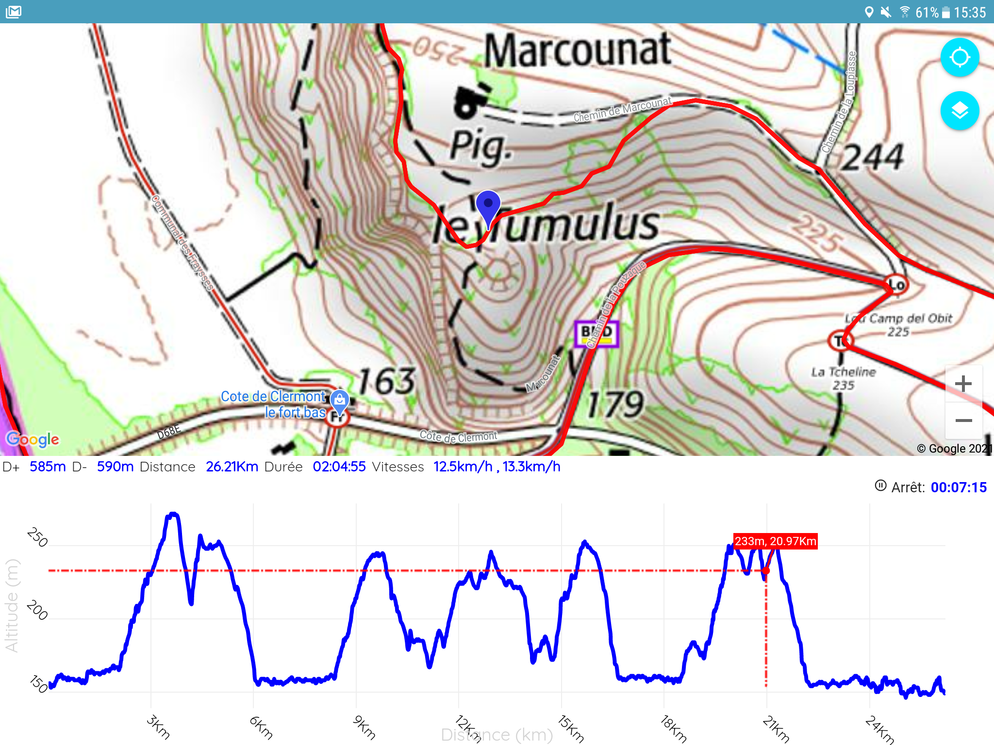
• As you progress, you can view the elevation profile on a graph and appreciate: your position, the fact, the rest to do, compare it with another route
• From a previously loaded route and thanks to the audio guide, you can listen to direction instructions such as "turn right" or "20 meters behind", "on the route" etc.... To avoid too many messages , the guide only gives you an indication if you leave the course or need to change direction.
• All tracks taken in the field or imported will be saved to your device. You can store a very large quantity without disrupting the proper functioning of the application. Numerous search and sorting criteria are available such as the distance of the route, location, proximity to a city, the name of the route, etc.
• Each of your routes can be recovered and shared in a GPX file. For each route, you obtain a route profile with movement statistics: breaks, positive or negative elevation, average speeds (with breaks or not), duration of effort, distance etc.... the algorithms calculations are reliable to respond to the reality on the ground.
• MA-Rando offers the retrieval of routes offered from the Utagawa site to import them directly into the application.
• MA-Rando offers aiming to display a target direction on the map in order to determine the target object such as a summit or a town.
• Getting started with the application is easy, the “Help” menu is available to help you. Videos are also there to better understand.
• Many parameters are available, and the configuration of each of them is accompanied by an explanatory description.
CONTACT & IMPROVEMENTS
Always wishing to improve our application and keen to provide you with the necessary help, do not hesitate to contact us: [email protected]
Thanks to MA-Rando, you have more than a GPS in your pocket.
Whether you are a hiker, on skis, on horseback, on mountain bike, on bike, on snowshoe, or you practice trail running, running, hunting or picking mushrooms,
MA-Rando is the essential tool you need.
MOST
• Sound guidance allowing you to follow a route.
• Conservation of the history of your courses in an optimized manner (Example more than 500 courses stored). You can find your routes quickly thanks to numerous search criteria such as routes around a city of your choice.
• The history of your routes is visible on all your devices via your Google drive and thus guarantees the saving of your routes.
• For your safety, sending your GPS position by SMS is available.
• Caching quality maps offline in the field
• The altitude difference and distance calculation algorithm has been worked on to be consistent with reality.
USES / FEATURES
• MA-Rando was designed to be intuitive and you will easily know how to use it.
• To orient yourself in the field, MA-Rando indicates your position on quality base maps such as: CalTopo, Thunderforest, French, Spanish, Swiss, Belgian, 4uMap, OpenTopoMap...
• Of course, MA-Rando allows you to record your trip and remains very economical since recording can be done over more than one day.
• To prepare your trip, you can download the maps of your choice in advance. This action will keep you secure because when you are away from any network, the base cards will remain displayed.
• As you progress, you can view the elevation profile on a graph and appreciate: your position, the fact, the rest to do, compare it with another route
• From a previously loaded route and thanks to the audio guide, you can listen to direction instructions such as "turn right" or "20 meters behind", "on the route" etc.... To avoid too many messages , the guide only gives you an indication if you leave the course or need to change direction.
• All tracks taken in the field or imported will be saved to your device. You can store a very large quantity without disrupting the proper functioning of the application. Numerous search and sorting criteria are available such as the distance of the route, location, proximity to a city, the name of the route, etc.
• Each of your routes can be recovered and shared in a GPX file. For each route, you obtain a route profile with movement statistics: breaks, positive or negative elevation, average speeds (with breaks or not), duration of effort, distance etc.... the algorithms calculations are reliable to respond to the reality on the ground.
• MA-Rando offers the retrieval of routes offered from the Utagawa site to import them directly into the application.
• MA-Rando offers aiming to display a target direction on the map in order to determine the target object such as a summit or a town.
• Getting started with the application is easy, the “Help” menu is available to help you. Videos are also there to better understand.
• Many parameters are available, and the configuration of each of them is accompanied by an explanatory description.
CONTACT & IMPROVEMENTS
Always wishing to improve our application and keen to provide you with the necessary help, do not hesitate to contact us: [email protected]
MaRando 4.22.07 Update
- Add your own tiled maps from a URL
- The display of your routes has been optimized and can be filtered and sorted for a very important management of the tracks
- Changes for Billing Google
- The display of your routes has been optimized and can be filtered and sorted for a very important management of the tracks
- Changes for Billing Google
Read More
Previous Versions More
GPS & Hiking maps
4.22.07
XAPK
APKs
September 8, 2024
10.22 MB
Requires Android: Android 8.0+
Screen DPI: nodpi
SHA1: 688bb8c53935c014bcbb7b70dbb91865d83b55d7
Size: 10.22 MB
What's New:
- Add your own tiled maps from a URL
- The display of your routes has been optimized and can be filtered and sorted for a very important management of the tracks
- Changes for Billing Google
- The display of your routes has been optimized and can be filtered and sorted for a very important management of the tracks
- Changes for Billing Google
GPS & Hiking maps
4.22.05
XAPK
APKs
August 17, 2024
10.22 MB
Requires Android: Android 8.0+
Screen DPI: nodpi
SHA1: 6208d18fefdce85a961b539b3f61ff3b37b5a1fd
Size: 10.22 MB
What's New:
- Add your own tiled maps from a URL
- The display of your routes has been optimized and can be filtered and sorted for a very important management of the tracks
- Changes for Billing Google
- The display of your routes has been optimized and can be filtered and sorted for a very important management of the tracks
- Changes for Billing Google
GPS & Hiking maps
4.22.04
APK
July 15, 2024
10.19 MB
Requires Android: Android 8.0+
Screen DPI: nodpi
SHA1: 0542ed9f878f2b41d40ee7d2bea964edb9409215
Size: 10.19 MB
What's New:
- Add your own tiled maps from a URL
- The display of your routes has been optimized and can be filtered and sorted for a very important management of the tracks
- Changes for Billing Google
- The display of your routes has been optimized and can be filtered and sorted for a very important management of the tracks
- Changes for Billing Google
GPS & Hiking maps
4.20.06
APK
June 11, 2024
9.18 MB
Requires Android: Android 8.0+
Screen DPI: 160-640dpi
SHA1: 9e2fe23e9a858da7ebdd6dc9d98eff84e85bf43a
Size: 9.18 MB
What's New:
- Add your own tiled maps from a URL
- The display of your routes has been optimized and can be filtered and sorted for a very important management of the tracks
- Changes requested by Google + Fixes
- The display of your routes has been optimized and can be filtered and sorted for a very important management of the tracks
- Changes requested by Google + Fixes
More Information
Package Name:
Category:
Update Date:
2024-09-08
Latest Version:
4.22.07
Need Update:
Available on:
Requirements:
Android 8.0+
Report:
You May Also Like
Uber - Request a ride
No-stress ride options. Save the hassle and find a car in your city.
9.2 953K+
Yandex Go: Taxi Food Delivery
Car and scooter rides, item and food delivery.
9.5 1M+
inDrive. Save on city rides
More than a taxi app! Save on city rides: Set the price & get more as a driver!
9.4 760K+
Waze Navigation & Live Traffic
Avoid delays. Get real-time GPS navigation, safety alerts and live traffic.
8.7 672K+
Bolt: Request a Ride
Bolt is a ride-hailing app for requesting fast, safe, and affordable transport
9.6 491K+